Summary
General Information
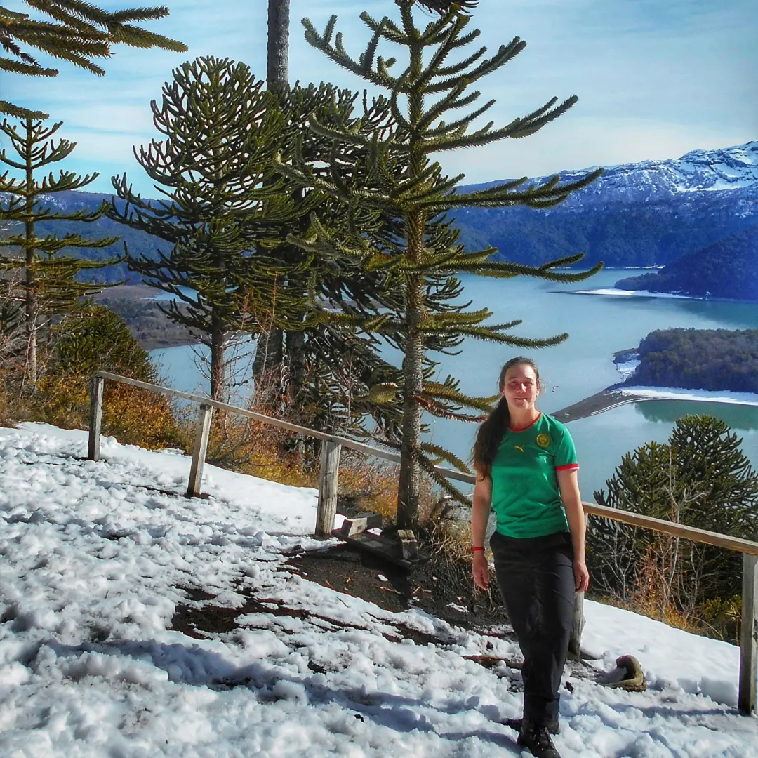
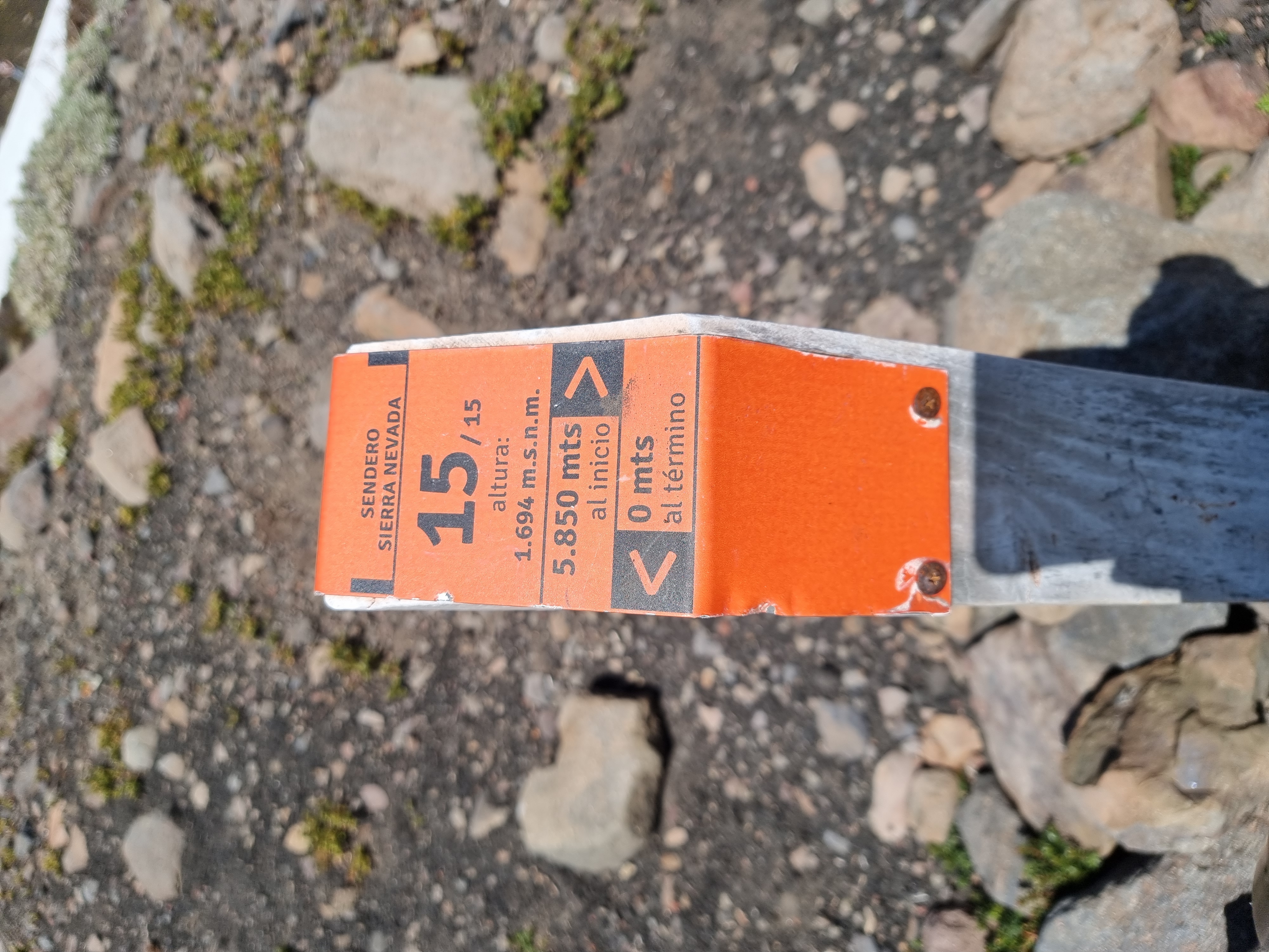
Mirador Sierra Nevada
Country: Chile
Region: Región de la Araucanía
Area: Parque Nacional Conguillío
Nearest city: Curacautín
Number of journeys: 1
Total distance: 6,1km (sólo ida)
Trail Markings: Frecuente y clara
Trail: Claro y marcado
Route type: Ida y vuelta
Fauna
Playas / Mar
Flora
Lagos / Lagunas
Bosques
Panorámicas / Paisaje
Transporte público
Apto para niños menores de 10 años
Los Contrabandistas, Parque Nacional Conguillío
Los Carpinteros, Parque Nacional Conguillío
Sendero Truful-Truful, Parque Nacional Conguillío
Laguna Espejo, Sierra Nevada
Laguna Arcoiris, Parque Nacional Conguillío
Las Vertientes, Parque Nacional Conguillío
La Ensenada - Laguna Verde, Parque Nacional Conguillío
La Huella del Puma, Reserva Nacional China Muerta
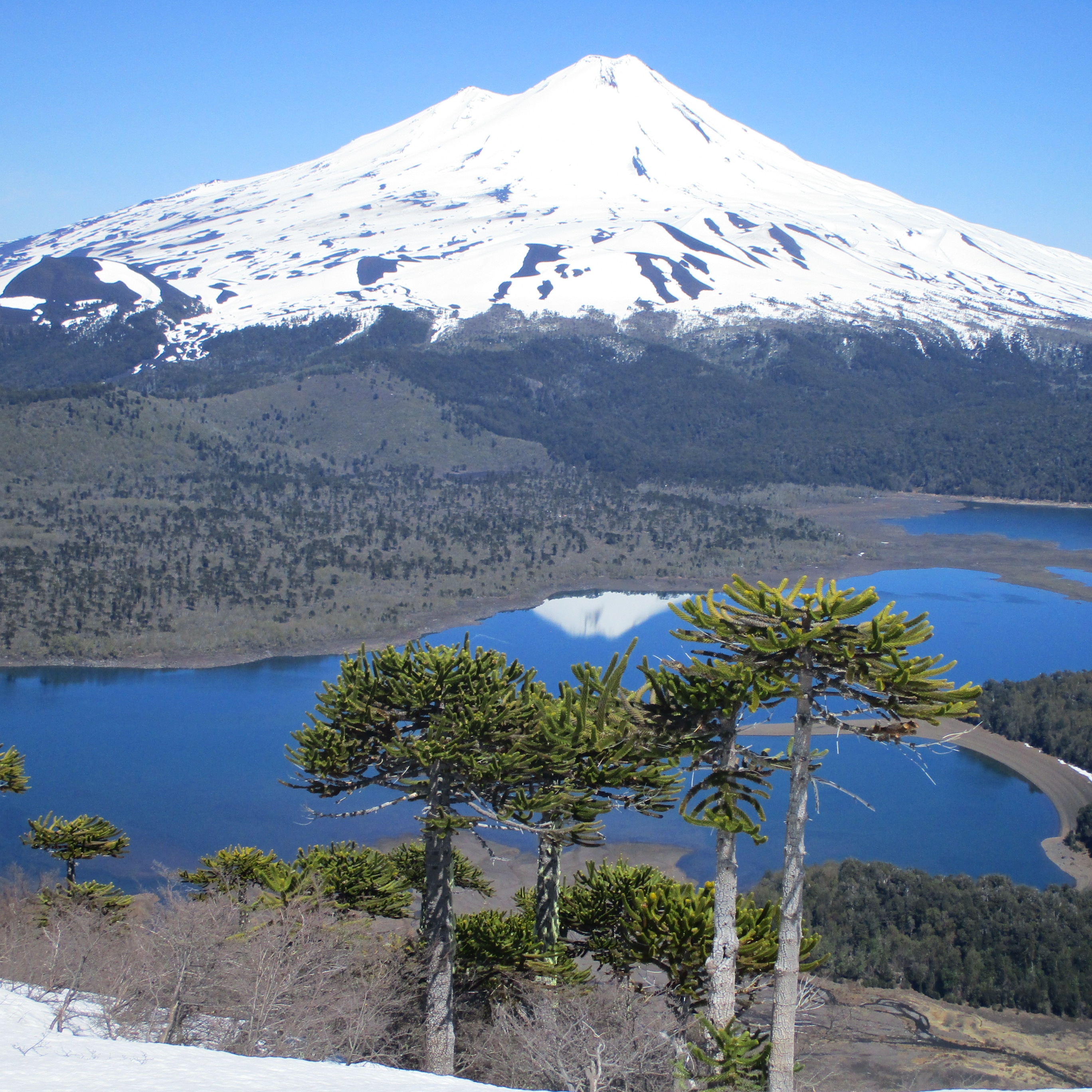
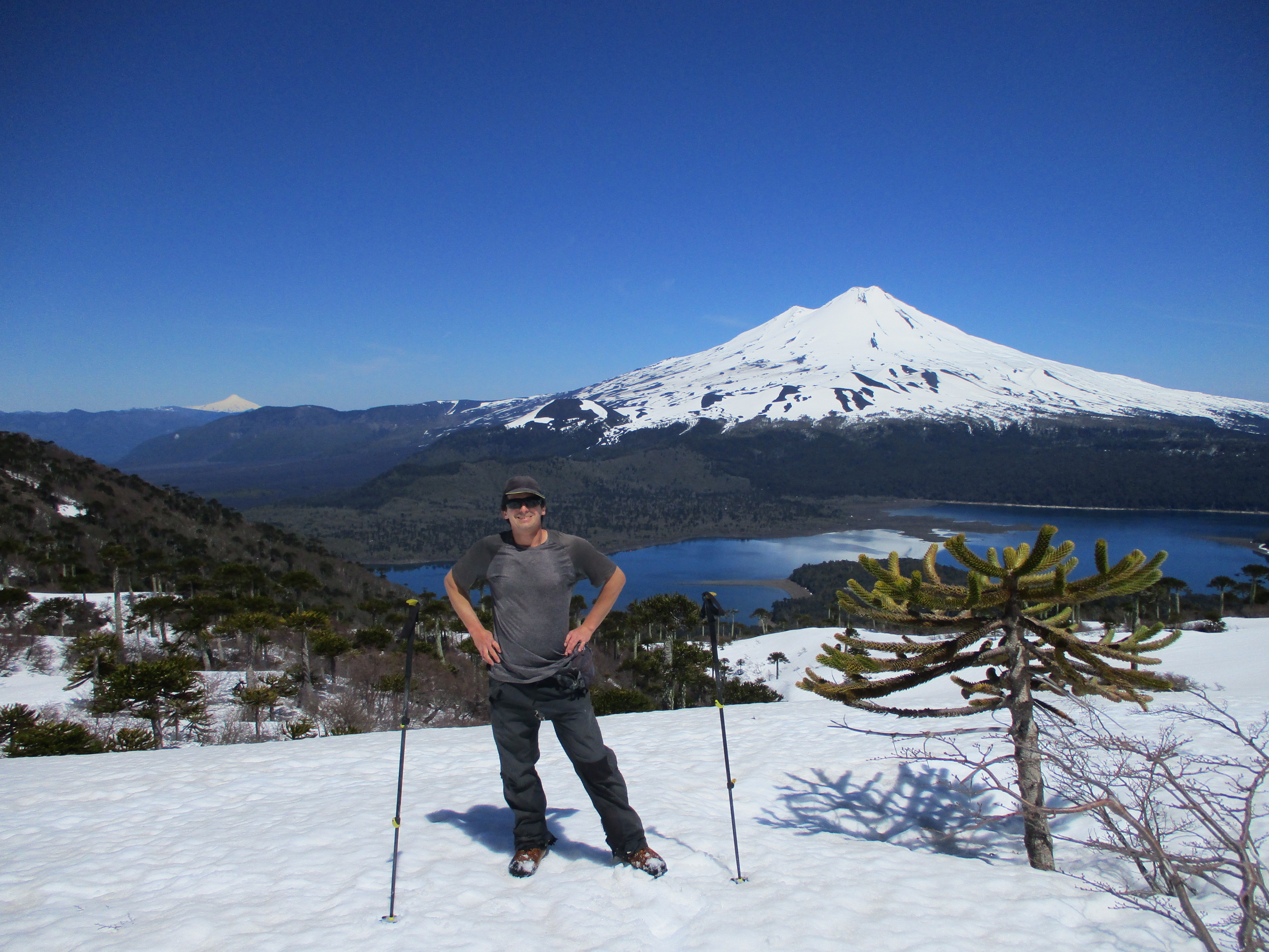
Volcán Llaima
Volcán Sierra Nevada
Difficulty:
I did it

Hiking routes
MIRADOR SIERRA NEVADA
Parque Nacional Conguillío
Author: Álvaro Vivanco
Introduction
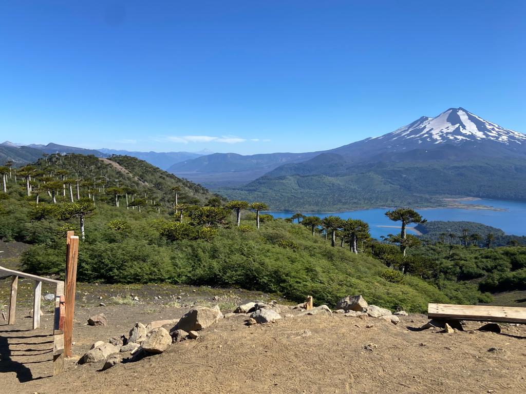
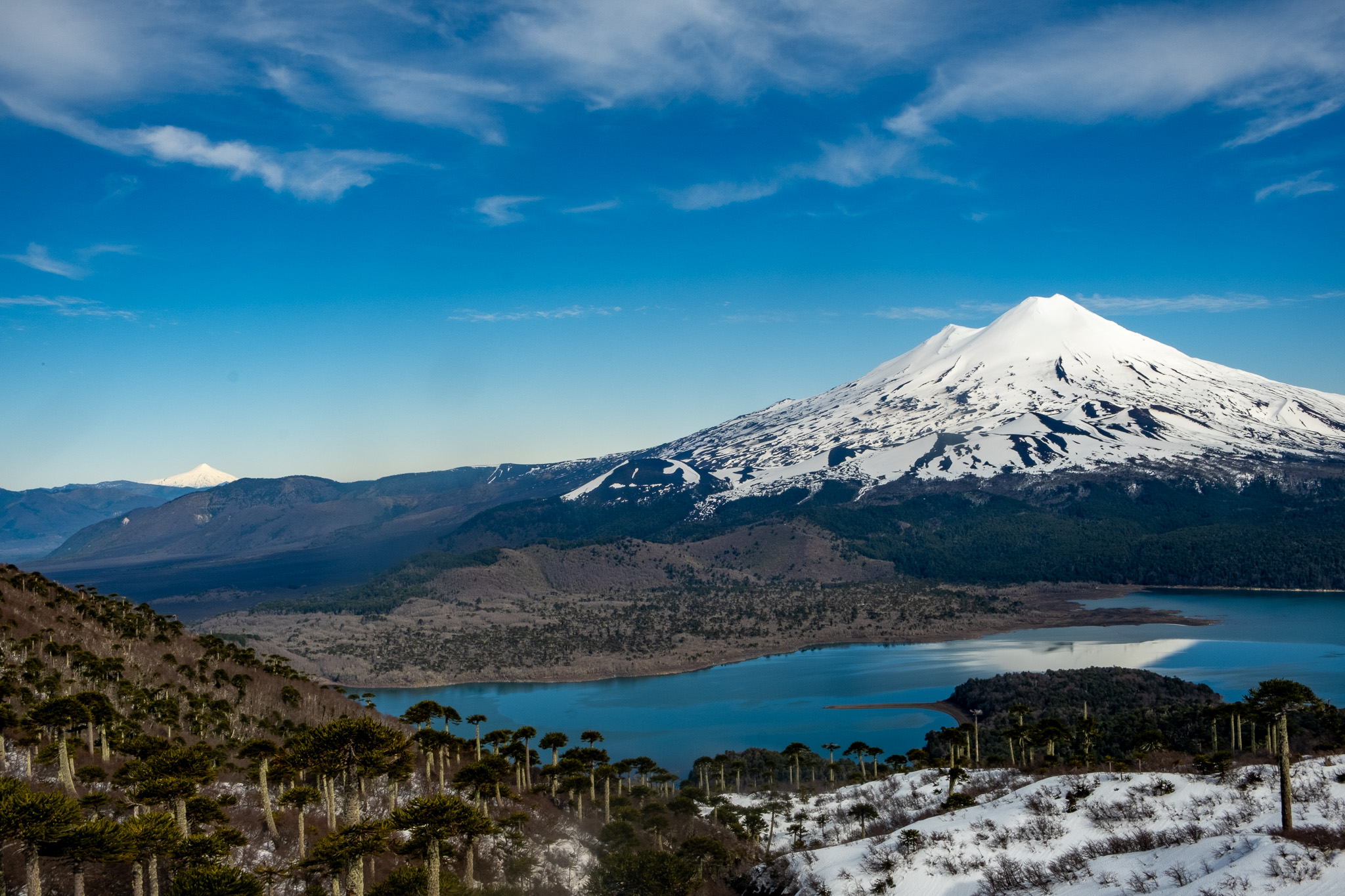
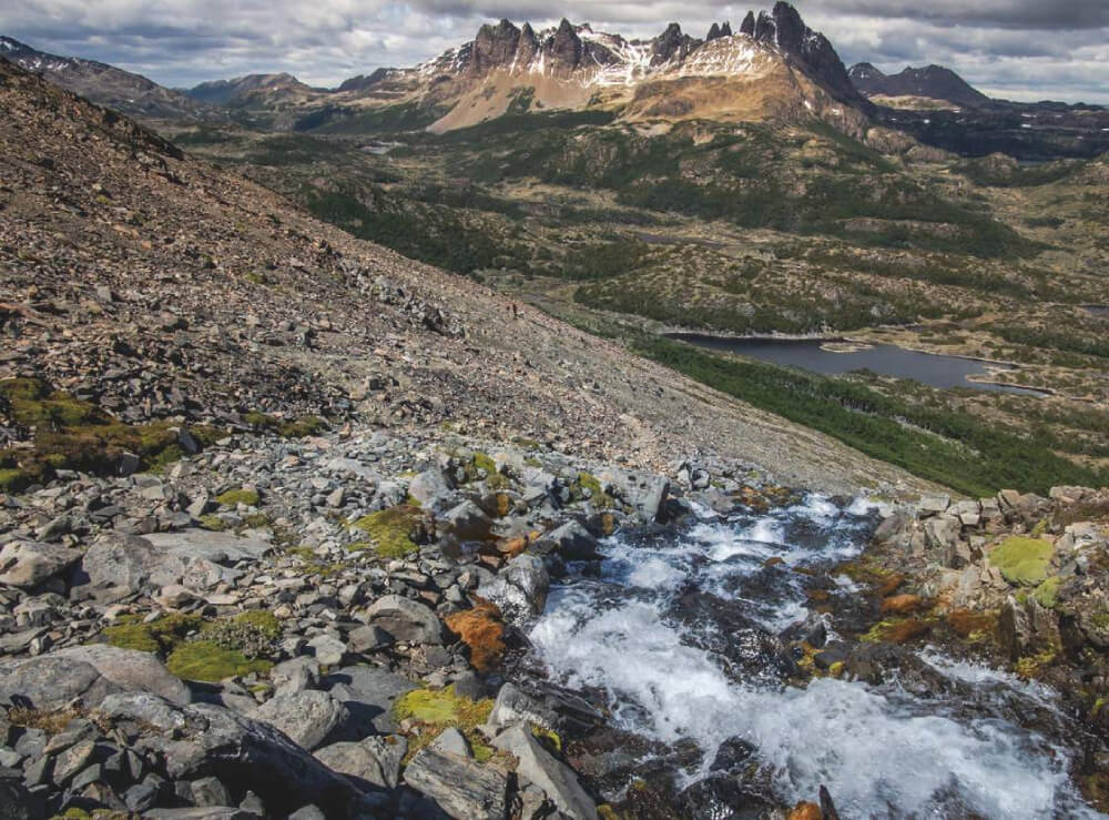
The Parque Nacional Conguillío must be one of the most extraordinary places that Chile has to offer to nature lovers. With two such spectacular volcanoes as Llaima and Sierra Nevada; myriad lakes; huge forests full of araucarias (Araucaria araucana); a variety of fauna; as well as other marvellous sights, this park is not to be missed when visiting the south of Chile. Of all the routes in the park, the route to the Mirador de la Sierra Nevada is the most accessible and offers the greatest variety of scenery and insight into the sheer wealth of nature that inhabits this zone.
The route starts by one of Lake Conguillío’s most beautiful beaches, leads through a native forest containing multiple viewpoints over the lake, and then ends at a great viewpoint which overs unspoilt views of the volcano Llaima as well as of Lake Conguillío. Despite the name of this route, you will not have many chances to see the Sierra Nevada, over whose skirts this route leads but never truly offers a moment to admire its magnificence and its enormous glaciers.
Appropriate season
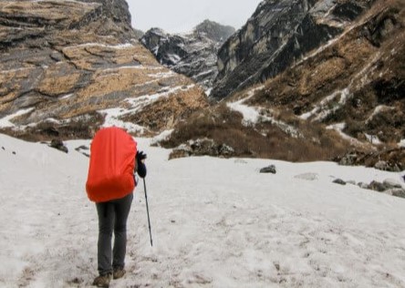
From October to May. In winter there can be a lot of snow along the route and the access routes to the park.
Access
Getting to Parque Nacional Conquillío
Private Transport
The Parque Nacional Conquillío is accessible from the north from Victoria o Lautaro via the village of Curacautín. The route is 84km over asphalt road. From Curacautín to the guardpost at Captrén is 34km, of which the first 10km are asphalt. From Captrén it is another 8km to Lake Conguillío along a dirt road which is only open when there is no snowfall. See here how to reach the Parque Nacional Conguillío from Curacautín:
MAP
It is also possible to reach the park from the south via the highway from Temuco to Cunco until you reach the village of Melipeuco (91km over asphalt road). Then it is another 9km until you reach the guardpost at Truful-Truful. From here continue for 20km over lava plains and through forests until you come to the forest of araucaria trees and Lake Conguillío. This road is accessible all year round, with access coordinated by Sendas (a private concession in the park) during the winter months.
There is public transport to Melipueco all year round. In summer the bus takes you all the way to the park. See here how to reach the Parque Nacional Conguillío from Melipueco.
The other option is from the west from Temuco along the highway via Cajón - Vilcún - Cherquenco - Sector Los Paraguas. The road is asphalt until Cherquenco, and then afterwards it is gravelled. It is accessible all year round apart from when there has been snowfall, and in these conditions you must use snow chains and a 4x4 vehicle. See here who to reach the Parque Nacional Conguillío from Cajón.
Public Transport
There are buses run by the company Sandra Vásquez Yáñez (Curacautín Express) which run a service from Curacautín to Captrén which departs on Mondays, Wednesdays and Fridays at 6:00, 9:00, 14:00 and 18:00, whilst on Tuesdays and Thursdays it departs at 6:00 and 18:00. the return service from Captrén to Curacautín leaves on Mondays and Fridays at 7:00, 10:00, 15:00 and 19:00, whilst on Tuesdays and Thursdays it leaves at 7:00 and 19:00.
Note than during winter the bus normally only goes as far as the Captrén guardpost (northern entrance to the Parque Nacional Conguillío), and this can vary according to weather conditions.
Another option is offered by the company Nar Bus / Igillaima, whose buses leaves from the Terminal Rural de Temuco (Avda. Anibal Pinto 32, Temuco) for Lake Conguillío. Monday to Saturday the buses depart at 10:30 and return at 14:50; on Sundays the buses leave at 9:00 and return at 17:45.
One last option is to go by bus to Melipeuco or Curacautín and from there you could buy a package from a tourist agency or find private transport to the park.
Getting to the start of the route Mirador de la Sierra Nevada
From the northern entrance (Captrén) to the park, continue for another 8.9km and follow Lake Conguillío around until you reach the end of the lake and arrive at the beach called Playa Linda.
From Melipeuco, you will enter via the southern entrance (Truful-Truful) to the park you will need to continue for another 26km, passing the lakes Verde and Arcoíris, until you reach the start of the trek at Playa Linda. This is signposted.
There is an area where you can park your car by the beach.
Permits / Prices
The entry fees to the park are as follows:
- High season: Chilean adult CLP$4000 (approx. US$8), non-Chilean adult (including older non-Chileans) CLP$6000 (approx. US$12), disabled adult CLP$2000 (approx. USD$4), Chilean child under the age of 6 free, Chilean children between 6 and 18 years of age CLP$2000 (approx. USD$4), foreign child CLP$3000 (approx. US$6), disabled child free, and Chilean adult over 60 years of age CLP$2000 (approx. USD$4).
- Low season: Chilean adult CLP$2000 (approx. US$4), non-Chilean adult (including older non-Chileans) CLP$6000 (approx. US$12), disabled adult CLP$1000 (approx. USD$2), Chilean child under the age of 6 free, Chilean children between 6 and 18 years of age CLP$1000 (approx. USD$2), foreign child CLP$1500 (approx. US$3), disabled child free, and Chilean adult over 60 years of age CLP$1000 (approx. USD$2).
High season is from November to March and low season is from April to October.
Accommodation / Facilities
The Parque Nacional Conguillío offers various areas where it is possible to camp, and these are currently run by the private company Sendas. There are also cabins in the park which are run by the same company.
There is a café and a small shop offering basic products (fresh bread, groceries, juice, wine and beer) on the main beach at Lake Conguillío. They are both open every day during high season.
There is also the option of staying in La Baita cabins outside the park. These are close to the southern entrance, at km18 on the road to Lake Verde. It also has a restaurant.
Recommendations
- Take enough water with you. There are points along the route where you can find drinking water but these are scarce.
- If you are visiting in summer, make sure to take your swimwear as you can bathe by Playa Linda after the trek.
Gear
- Light walking boots
- Trekking poles (optional)
Schedule
- Curacautín – Mirador Sierra Nevada – Curacautín


Comments
Mirador Sierra Nevada
Milton Matamala Sanhueza 27/03/2025
Punto alcanzado: 1694 msnm
Fecha expedición: 07/12/2025
Llegue al mirador después de una caminata corta pero empinada. La vista del Volcán Llaima y los alrededores es increíble, especialmente con el cielo despejado. El terreno es accesible, pero el viento puede ser fuerte, así que se recomienda llevar abrigo. Un lugar ideal para los amantes de la naturaleza.
Fernando Soffia 28/02/2024
Other excursionists: Carmen Alcalde, Isabel Soffia, Elena Soffia, Mateo Soffia
Punto alcanzado: Mirador Sierra Nevada
Fecha expedición: 18/02/2024
Maravilloso paseo familiar. Día muy caluroso, hay agua arriba.
Nicolás Berríos 29/03/2024
Other excursionists: Marjorie Carvajal
Punto alcanzado: Mirador
Fecha expedición: 13/08/2023
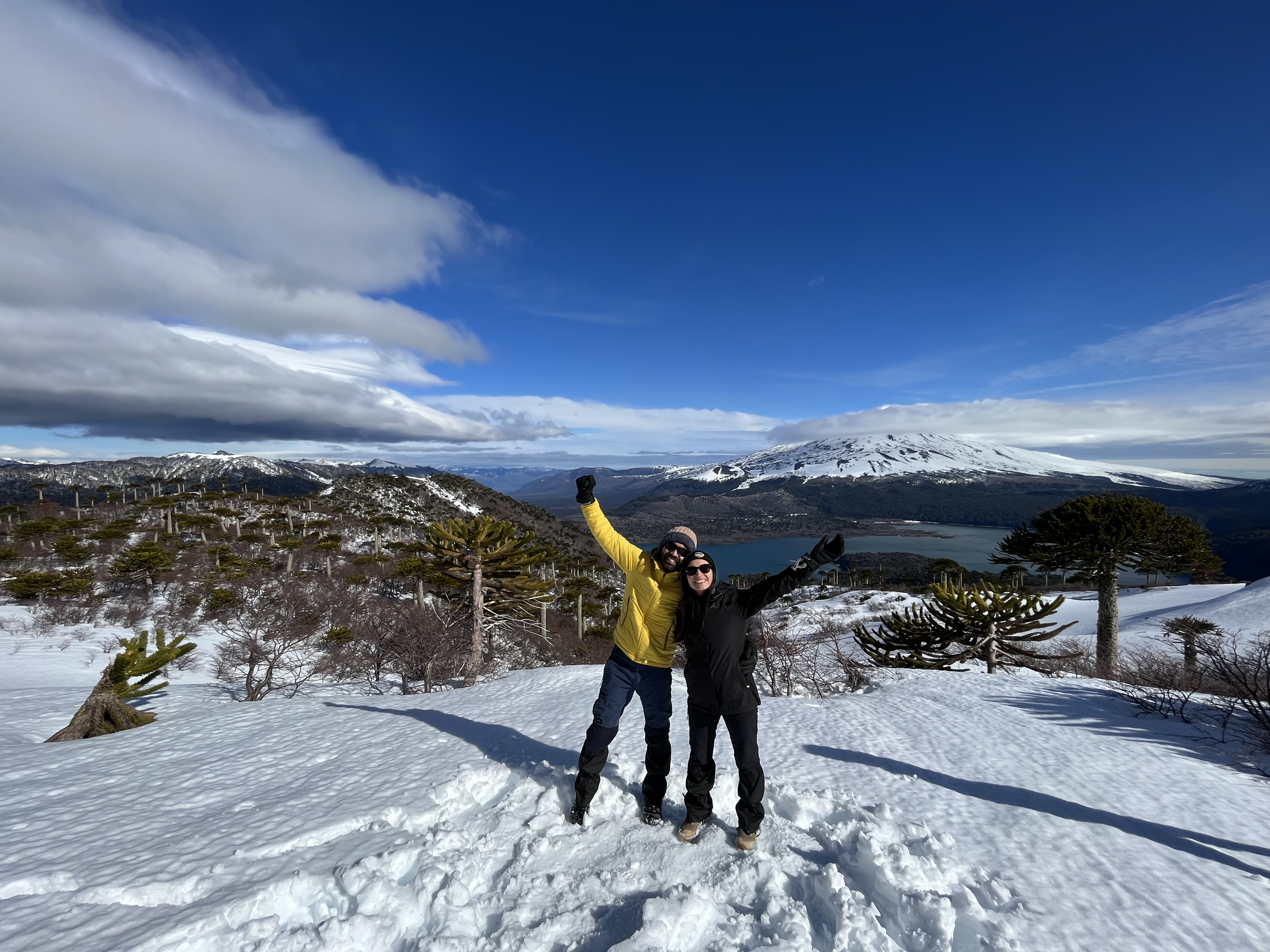
Uno de los senderos mas bellos de Chile. Invernal y con nieve el espectaculo que puedes contemplar es sencillamente maravilloso.
Carolina Muñoz 08/08/2023
Punto alcanzado: Pasado el mirador sierra nevada
Fecha expedición: 05/08/2023
Bastante hielo en el camino que durante la tarde se fue derritiendo. Trekking fácil, camino amigable y pocas pendientes.
Laura Ruas 02/08/2023
Fecha expedición: 01/07/2023
Este año (2023) habia mucho menos nieve y fue posible hacerlo sin raquetas en invierno
Cristián Arriagada 23/10/2022
Punto alcanzado: CB del Sierra Nevada
Fecha expedición: 22/10/2022
Lejos, el mejor trekking del país. El más estético, interesante. Perfecto.
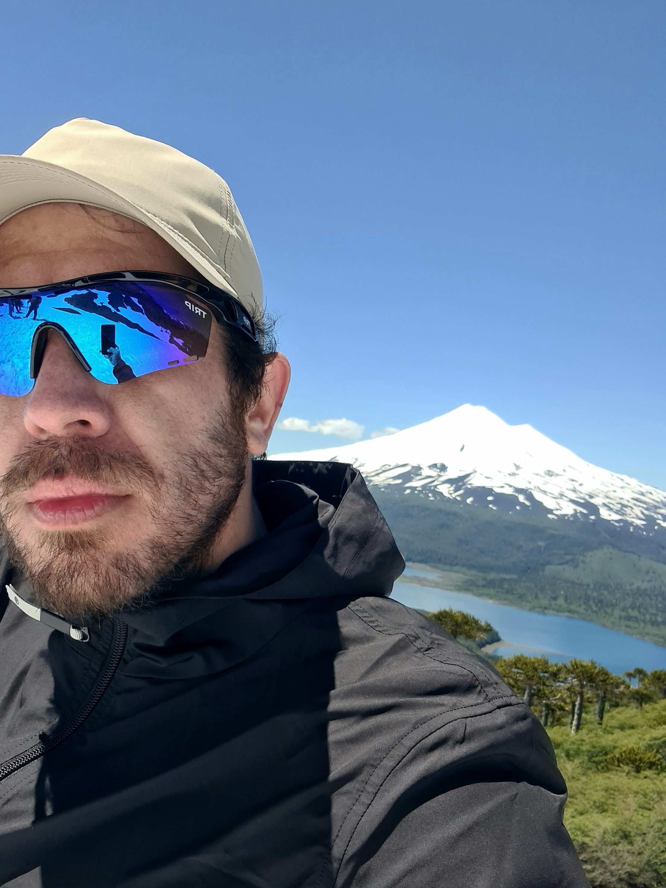
Cristián Arriagada 24/10/2022
Punto alcanzado: CB del Sierra Nevada
Fecha expedición: 22/10/2022
Excelente paisaje, y con mi facherío y varonil sensualidad le da un plus a la foto.
Joaquin Boutaud 04/01/2022
Punto alcanzado: Mirador Sierra Nevada
Fecha expedición: 20/11/2021
Sendero bien señalizado, de fácil trayecto, ideal para hacerlo en familia. Última parte tiene nieve lo que representa cierta dificultad a finales de noviembre. La vista es maravillosa al Llaima, Laguna Conguillio y al inicio del sendero a la Sierra Nevada.

I did it!