Summary
General Information
Normal Route
Country: Chile
Region: Región de Arica y Parinacota
Area:
Face: Norte
Altitude gain: 0 m.
Number of journeys: 0
Trail: Claro y marcado
Year First ascent: 1928
First ascent:
Joseph Prem y Carlos Terán.
Travesía en glaciar
I did it

Mountain route
NORMAL ROUTE
Appropriate season
Between May and December. The best season for climbing Parinacota is during the winter months, during which the weather is very good and stable, besides from the snowfields being very compact. Early in the year (January-February) there may be too much snow, and late into the season the presence of big penitentes may hinder the climb. It is important to avoid the period of the so called "Bolivian Winter" (austral summer), since it is precisely then that the weather turns unstable and rainy. Another important fact is that the winter, apart from being more stable, is also colder, and must be considered when choosing the proper clothing.
Access
From Arica follow route 11 to Putre (3600 masl aprox.), important stop in the acclimatization process. Then continue 44 kms. to the little village of Parinacota. From Parinacota, follow the road which will take you to Caquena, place where all expeditioners must register at the police post before continuing. It is then necessary to go back a few kilometers (until km. 26 from Parinacota) and take the detour which heads south-southeast and which circles the marsh along its western border. This road, only feasible on a 4x4, due to the sand, reaches the end of the marsh, a place called Rinconada. There are some stone parapets and lives a man who raises animals, and who has a well from where he gets drinking water. In case of need, ask him for water, since the water from the marsh isn´t drinkable. A first camp is set up here, in order to acclimatize and continue early the next day.
Approach
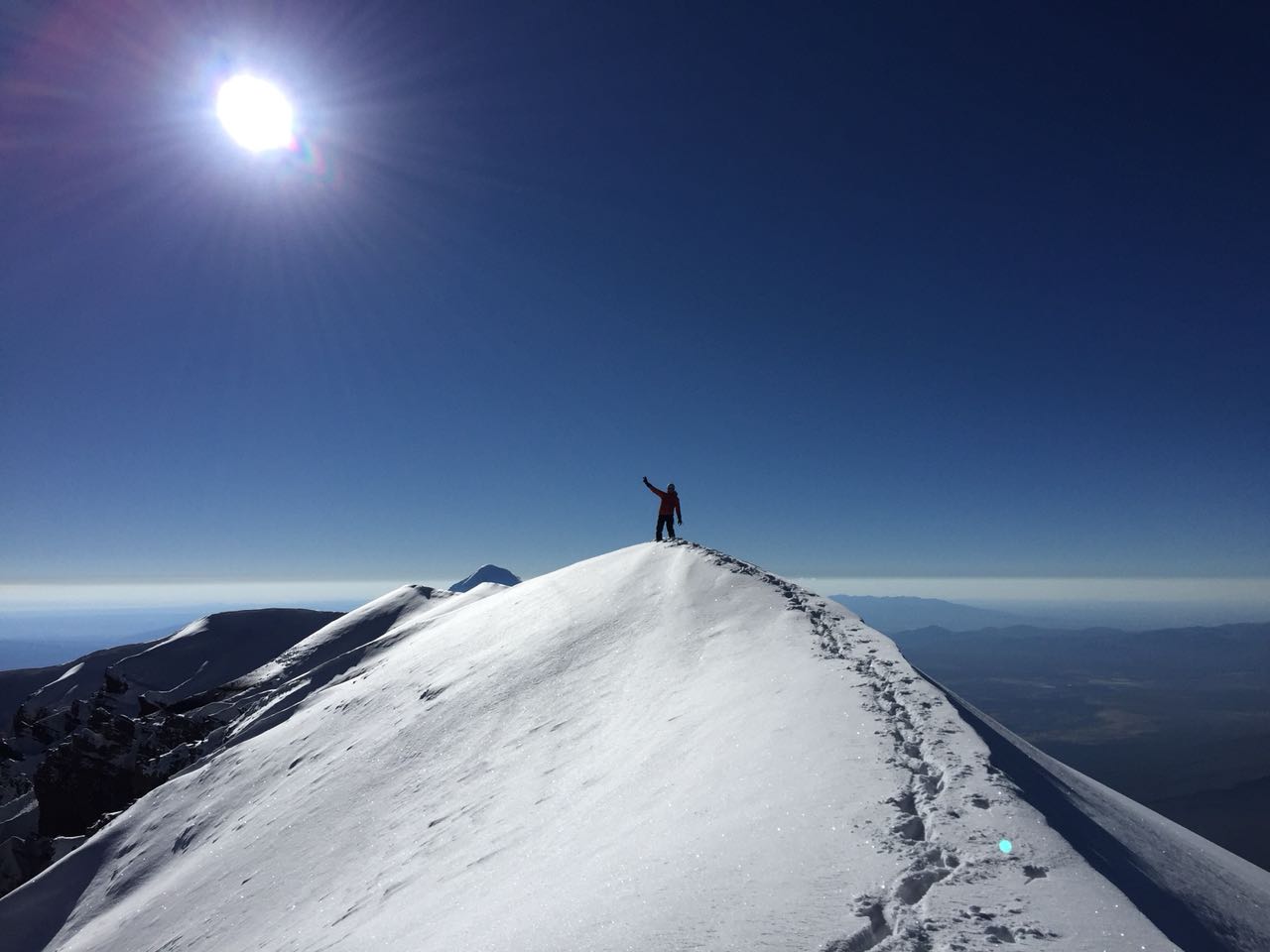
At Rinconada, on the southern border of the marsh of Caquena, starts the journey towards the volcano´s base. Though there is no obvious trail, it is hard to get lost, since the volcano is always visible. See photo 2. It is aproximately 7 hours of tiresome walking on sand until reaching the snowline, which varies from year to year and with the season. It is important to camp near the snow in order to have drinking water. The summit bid starts is done from this camp.
Note: depending on the vehicle and on the driver´s skill, it will be possible to advance by vehicle several kms more towards the volcano, thus saving precious energy for the summit day.
The climb
From base camp, on the volcano´s north face, the climb starts circling the volcanic cone in east direction, and then going straight for the summit. The volcano being an almost perfect cone, the route is pretty obvious, and it is difficult to get lost if you keep going up. Initially the gradient is more or less 30º, getting a bit steeper near the end, up to 45º. After 6 to 8 hours climbing, you will reach the border of an inmense crater, which must be circled to the right in order to attain the highest point. During dry seasons there may be some bergschrunds or open crevasses before the crater. It is important to start the summit bid very early, in order to descend with daylight, since the ascent may be pretty long and exhausting. Crampons and ice axe are always required in order to advance securely and for self arresting in case of a fall. The descent takes 3-4 hours, camp being always visible, the same as the marsh, so it is easy to find the way back if descending with daylight.
Recommendations
Gear
Schedule
Schedule 1
- Putre – Rinconada
- Rinconada – base camp (at the snowline)
- Base camp – summit – base camp
- Base camp – Putre
This itinerary considers previous acclimatization and starting from Putre.


ROUTE STATUS
Normal Route | Volcán Parinacota.
El propósito de los reportes de estado de ruta es entregar información reciente acerca de las condiciones de una ruta en particular. No es condición para hacer un reporte de ruta que hayas llegado a la cumbre. Muchas veces la ascensión completa de la ruta se debe a la existencia de un impedimento de realización reciente sobre el cual es muy importante compartir información para quienes están preparando una visita al cerro o ruta ¿Has intentado esta ruta recientemente? Entonces entrega tu reporte del estado de la ruta aquí. Para hacerlo debes logearte o registrarte.
Cédric babec06/05/2018
Punto alcanzado: Cumbre
Fecha expedición: 01/05/2018
Cumbre en excelente condiciones no usamos crampones, 4h20 desde campo 5300m, hubiese sido esquiable...
Jose Quinchel Ibáñez05/10/2016
Punto alcanzado: Cumbre
Fecha expedición: 20/09/2016
Salimos desde un campamento a los 5.200msnm aproximadamente, tardamos cerca de 11 horas en llegar a la cumbre, al llegar al glaciar que estaba a los 5.900msnm aprox. no encontramos con penitente que alcanzaban fácil 1 1/2 m. luego bordeamos en dirección hacia Bolivia y encontramos un sendero por un acarreo bastante firme que nos llevo hasta la cumbre.
Francisca Saavedra01/08/2016
Punto alcanzado: Cumbre
Fecha expedición: 25/07/2016
Salimos desde el campamento alto (5600 aprox) a las 5:00 am. El volcán se encontraba con muy poca nieve, por lo que tuvimos importantes tramos de acarreo de piedra y arena. El hielo estaba con escalones y al final con muchos penitentes, bastante agotador. Hicimos cumbre a las 13:30 aprox. con mucho viento y frío, pero con una vista que lo paga de todas maneras. Muy recomendable.
Rodrigo Arancibia Araya25/03/2017
Punto alcanzado: Cumbre
Ascensión de altura, algunos penitentes y hielo en buen estado.

I did it!