Summary
General Information
Reserva Nacional Malalcahuello
Sendero Tres Arroyos
Country: Chile
Region: Región de la Araucanía
Area: Reserva Nacional Malalcahuello
Nearest city: Temuco
Number of journeys: 1
Total distance: 2,07 km
Trail Markings: Esporádica
Trail: Claro y marcado
Route type: Ida y vuelta
Fauna
Cascadas / Ríos
Flora
Bosques
Transporte público
Señal de celular
Apto para niños menores de 10 años
Difficulty:
I did it

Hiking routes
SENDERO TRES ARROYOS
Reserva Nacional Malalcahuello
Author: Juan Romero (CL).
Introduction
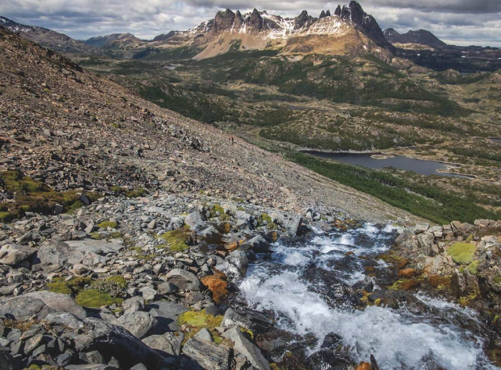
The route Tres Arroyos is found in the Reserva Nacional Malalcahuello, in the IX La Araucanía Region of Chile. It is located between the communes of Curacautín and Lonquimay in the province of Malleco. The River Cautín begins in the reserve and is a tributary of the River Imperial, this being considered as the most important body of water in the region. Within this protected area you will find the famous volcano Longuimay which is a favourite with tourists, as well as offering a location for winter sports, observing flora and fauna, excursions, fishing and photography among other pastimes.
Regarding the types of fauna found in the reserve, you can observe birds such as the Chucao tapaculo (Scelorchilus rubecula), the Slender-billed parakeet (Enicognathus leptorhynchus) and then Magellanic woodpecker (Campephilus magellanicus) as well as mammals like Monito del monte (Dromiciops gliroides), the South American gray fox (Lycalopex griseus), the culpeo (Lycalopex culpaeus) and the Puma (Puma concolor). There is a varied range of reptiles with the most significant being the culebra de cola corta (lit. short-tailed snake; Tachymenis chilensis). It is also a habitat for diverse vegetation such as the Coigüe (Nothofagus dombeyi), Raulí beech (Lophozonia alpina), Tepa (Laureliopsis philippiana), Lenga beech (Nothofagus pumilio) and the thousand year old Araucaria (Araucaria araucana).
The trail Tres Arroyos is 2.5km in distance (there and back), and ends once it arrives at the River Tres Arroyos. It is not physically demanding, and hence is suitable for the whole family.
Appropriate season
All year around.
Access
It is 121km to the start of the trail from Temuco. The main route of transport is via the international road towards the Republic of Argentina in Longuimay, along the pass Pino Hachado. To get here, you will first need to reach the village of Curacautín:
- The first option is to head from Temuco to the village of Lautaro, located some 31km to the north. From here, follow route S-11-R heading east for 54km until reaching Curacautín.
- The second option is to head to the city of Victoria which is 63km to the north of Temuco and located on the Southern Pan-American Highway. From here, continue along routeR-181 heading east until you arrive Curacautín.
From Curacautín, continue east along route R-181 for another 29km. This leg of the road is paved and is open to all types of vehicles all year round apart from when there is heavy snowfall which can interrupt travel. Either way, take care with the hairpin bends between Curacautín y Malalcahuello.
Once you reach the village of Malalcahuello, keep following route R-181 until reaching the police post. Continue for another 500m from here until you see a sign for the Reserva Nacional Malalcahuello on the left hand side of the side (north). From here, walk 100m heading northeast, from where you will see the start of the route.
There is public transport from Temuco bus terminal to Lonquimay; the companies Erbuc and Biobio provide services along this route and drop you off at the start of the route. It is advisable that you tell the driver where you wish to get of beforehand. Up to date information can be found on the Temuco bus terminal website.
Permits / Prices
The entry fees to the reserve are as follows: adult CLP$1000 (approx. US$2), child CLP$500 (approx. US$1). At the entrance all excursionists are requested to provide the following information:
- Region and place of origin
- Number of children, adults and pensioners.
- Mode of transport.
- Registration plate of vehicle (if applicable).
- The route which will be completed in the reserve.
- Time of entry.
Accommodation / Facilities
There is no accommodation in the reserve, however you can pitch a tent in the garden of the administration, this depending on their consent.
Recommendations
- Be aware that the markers for this route are green as there are various routes which can prove a little confusing.
- Do not trust the 2015 edition map which shows the route to be orange, as the current markers are green and are part of the route El Raleo.
- In summer the UV radiation can be extremely high so we recommend that you use sun protection when completing this route.
- The reserve is open from 8:00 to 18:20. In the even that you arrive back after 18:20, Conaf have put up a board by the administration entrance where each group or individual should communicate that they have arrived back. In case of an emergency, contact Iván Bolívar Bravo (95452224), the administrator of the reserve and who lives just a few metres away from the administration centre.
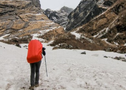
Gear
- Basic trekking equipment
- 1L bottle of water
- Food provisions
- Trekking poles (optional)
- Hat
- Sunscreen
Schedule
- Temuco - Tres Arroyos trail - Temuco


Comments
Sendero Tres Arroyos
Juan Romero 10/07/2015
Punto alcanzado: 1125m
Fecha expedición: 17/02/2015
Una ruta de fácil recorrido pero muy abandonada en cuanto a señalética, la existencia de cercos que cruzan el camino dificultan el transitar de esta.

Belleza escénica durante todo el recorrido.
Tracks and Waypoints
Sendero Tres Arroyos
Colaborador: Juan Romero
Fecha: 08/02/2016
RN Malalcahuello-Sendero Tres Arroyos
Colaborador: Juan Romero
Fecha: 20/03/2015
Archivo .KML para poder visualizarlo en Google Earth

I did it!