Summary
General Information
Normal Route via Yerba Loca
Country: Chile
Region: Región Metropolitana
Area:
Face: Sur
Altitude gain: 3100 m. desde From Villa Paulina
Number of journeys: 3
Trail: Claro y marcado
Year First ascent: 1943
First ascent:
Jorge Alig, Hans Moser, Otto Pfenniger, Richard Keller y Hugh Powers
Travesía en glaciar
I did it

Mountain route
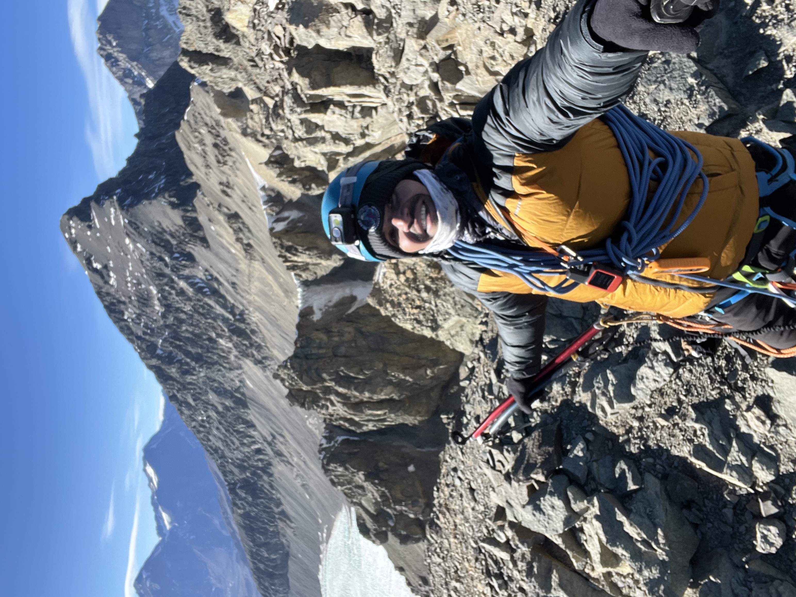
NORMAL ROUTE VIA YERBA LOCA
Author: Paulo Cox
Appropriate season
Between the end of November and the end of March, although you should take care with the beginning and end of the season. You will find the glacier more open at the end of summer, with some bergschrunds that stand out and covered with enormous penitentes. At the end of spring, take care of hidden crevasses and possible avalanches.
Access
Take the road to Farellones. It's 22 km until the entrance of the Yerba Loca Nature Preserve (Reserva Natural de Yerba Loca), operated by the Chilean National Forestry Corporation (Conaf). You will find the entrance halfway up the road which goes up toward the ski centers of Farellones (El Colorado-Farellones, La Parva, and Valle Nevado), at curve 15. Once at the entrance, expeditioners have to register and pay a set price per person, per day of stay.
From this point, located at approximately 1600 meters, a dirt road of 4 kms., accessible by auto, leads to Villa Paulina (1950m). Here starts the excursion, although many like to stay here to have a cookout, or camp. Many years ago, Villa Paulina, was a mining village that exploited the mines of the Yerba Loca Valley. Today, a beautiful forest and some pines have made the place very welcoming and tempt the visitor to lie down in it's fields.
Approach
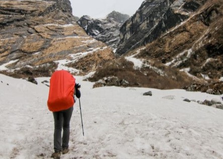
Yerba Loca is a long valley. It is approximately 20 kms.(in straight line) from its entrance to its end. The name of the valley, and the stream that crosses it, comes from a very common mountain herb of the central zone: "yerba loca". The trail runs through the valley and is wide and clear, and until Piedra Caravajal it is on the east of the principal stream, Yerba Loca. You can see several tracks on the hillsides, left by mule drivers, guanacos, mules, and probably Incas that roamed the valley in other times. Nevertheless, none of these trails serve for our purpose, which is to reach the mountain as quickly as possible.
Following the principal trail, which is of shallow grade, and interrupted approximately every hour by some course of water that falls from the range of hills east of the valley (only from these streams is it recommended to drink water, because the stream of Yerba Loca contains levels of minerals that are not very healthy for human beings), one arrives at the traditional camping place: Piedra Carvajal (5 or 7 hours).
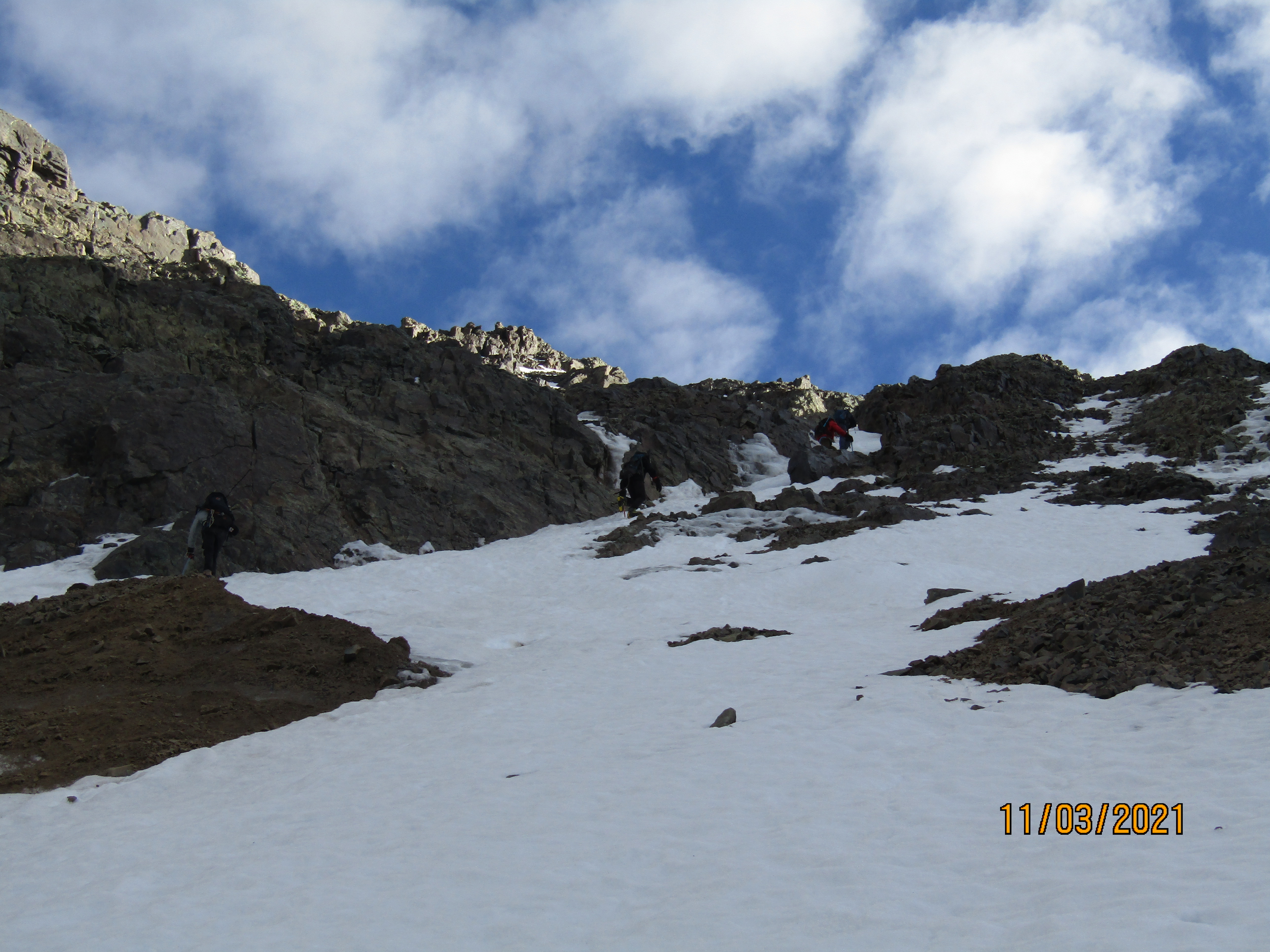
Piedra Carvajal (3200m) is just on top of a promontory that rises from the feet of a huge waterfall (frozen in the winter) verFoto4, that you see at the end and the right of the valley when we continue in the direction of the peak (the waterfall of Sulfatos, the principal tributary of Yerba Loca). One climbs this hill in an hour or hour and a half. Once on top, on one side of the base of Falso Altar, a large plateau of meadows and a pond demarcate the traditional camping place. Under the west ridge of the valley, crossing the river that comes from the glaciers of Paloma and Altar, you find a stone shelter used by horsemen that also serves as a campsite (Casa de Piedra Carvajal). This is a protected place, with some basic provisions for subsistence, but full of rodents!
You will find another optional place for camping after one hour of walking, following the course of the river until a point where it is possible to see the lower part of the enormous hanging glacier of Paloma (which is some 300 meters distant from this point, in a straight line), in front of Morro Negro, at some 3500 meters of altitude. The old custom was to use this place as a campsite, since in other times there was a refuge built by the Andean Federation.
There also is the alternative to pitch a second camp on a plateau that you find in the middle of the snowfields that you must climb to find the summit. You will find this place at approximately 4100 meters, some two hours from the refuge with packs (normally you will have to melt snow at this camp).
The climb
From Piedra Carvajal to the summit takes between 6 and 8 hours. Once in the sector of the hanging glacier, you should follow the snowfield adjacent to Morro Negro and the glacier, following along the west side of the rocky ridge of the Morro the long snowfield towards the north. Once reaching the plateau, it requires between an hour and hour and a half to reach the end of the valley (4.650m), the place where the route turns perpendicularly towards the east, and from where it is possible to see the summit for the first time. During the climb up to here, you cross a sector of hard ice with crevasses and small bergschrunds of very little difficulty (Glaciar del Rincón, or Corner Glacier).
Finally, in less than one hour, you make a traverse over the final portion of the glacier, of gentle grade, that leaves us some 100 meters from the summit, which you can reach after climbing a scree slope.
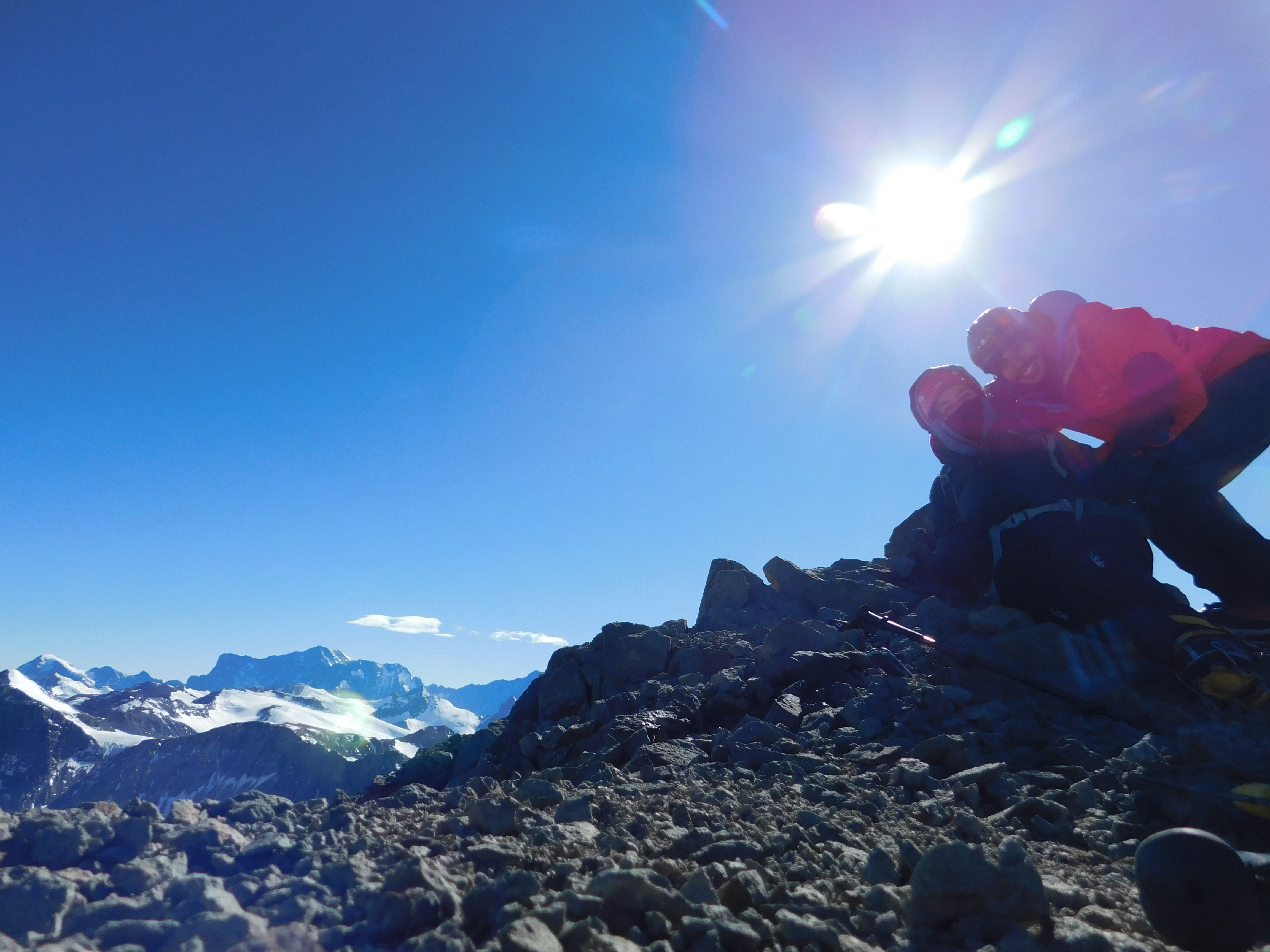
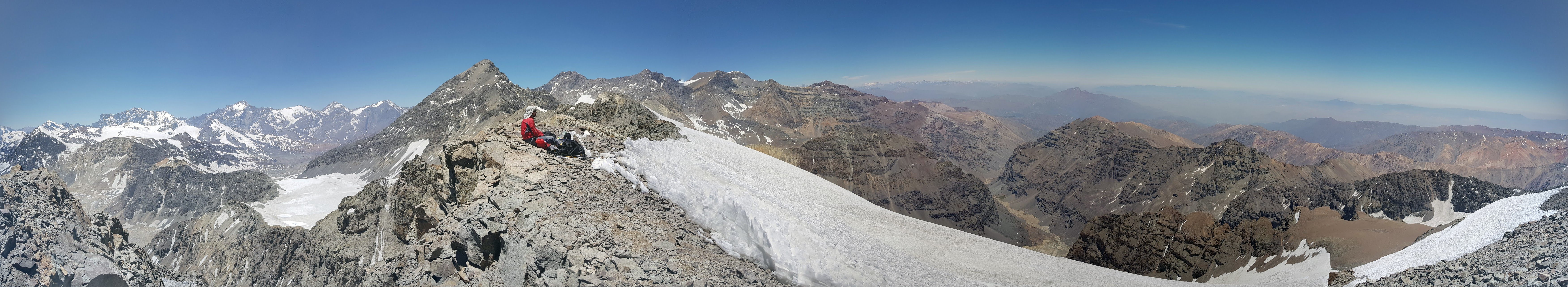
The summit ridge is long, and a bit exhausting, very airy towards the north face, and a little exposed towards the south. In the traverse over the ridge, many will lose sight of the highest point. verFoto3.
From the summit ridge, you have a very good view of all of the great peaks of the sector, and the enormous open pit mine La Disputada, which you can feel roar during the nights at high camps (verFoto2).
Those more strong or motivated can follow the ridge in search of Cerro Altar, which is climbable via this way.
Recommendations
Gear
Schedule
Schedule 1
- Stgo-Piedra Carvajal
- Piedra Carvajal-Summit-Piedra Carvajal
- Piedra Carvajal-Stgo
Traditional itinerary
Schedule 2
- Santiago - Camp prior to Piedra Carvajal
- Camp- camp on the plateau
- Plateau - Summit - Santiago
This itinerary is followed when climbing the mountain in a weekend, using friday afternoon to make some progress.


ROUTE STATUS
Normal Route via Yerba Loca | Cerro La Paloma.
El propósito de los reportes de estado de ruta es entregar información reciente acerca de las condiciones de una ruta en particular. No es condición para hacer un reporte de ruta que hayas llegado a la cumbre. Muchas veces la ascensión completa de la ruta se debe a la existencia de un impedimento de realización reciente sobre el cual es muy importante compartir información para quienes están preparando una visita al cerro o ruta ¿Has intentado esta ruta recientemente? Entonces entrega tu reporte del estado de la ruta aquí. Para hacerlo debes logearte o registrarte.
Paolo Retamal06/05/2025
Punto alcanzado: Cumbre La Paloma
Fecha expedición: 03/05/2025
Mi intención era La Paloma y Altar, el Primer día tuve que improvisar campamento a los 3400 aprox no alcance más arriba, segundo día campamento en la laguna a los 3800m, tercer día cumbre y bajada al auto 36km aprox, ruta dificil y agotadora sobre todo por el acarreo posterior al glaciar el rincón para montarse en el filo cumbrero esta peligroso, si use piolet y crampones por seguridad, último tramo de la Paloma con nieve, zonas muy expuestas y algunas escaladas con roca muy mala, no lo recomiendo en estas fechas, empecé 3am con cumbre 9 am.
Diego Montero22/04/2025
Punto alcanzado: Cumbre (4.910 mt)
Fecha expedición: 19/04/2025
Larga jornada de 8 hrs desde Piedra Carvajal. Había muy poca nieve y los tramos con glaciar fue factible sortearlos con éxito, por lo que no fue necesario el uso de piolet ni crampomes. El acarreo es la tónica del ascenso, lo que hizo la ruta excesivamente agotadora.


Cordada: Shannen Daniels, Raimundo Novoa, Loreto Fontaine, Rodrigo Pérez, Diego Montero.
Fernando Aguayo14/02/2021
Punto alcanzado: Cumbre
Fecha expedición: 12/02/2021
Harta nieve en la ruta, dura en la sección del glaciar y a comienzos del filo. Últimos 300 metros con nieve polvo. Nos tomó unas 5.30 desde el CB al lado del mirador del glaciar
Pablo Barros16/04/2021
Punto alcanzado: cumbre paloma
Fecha expedición: 11/02/2021
Nieve en toda la canaleta después del glaciar. Filo sin nieve. 7.00 horas desde el CB en el mirador del glaciar, nos dimos hartas vueltas en el acarreo que sube al Glaciar del Rincón, recomendable andar con GPS.
Damir Mandakovic26/12/2019
Punto alcanzado: Cumbre
Fecha expedición: 02/11/2019
Condiciones perfectas, al descenso la nieve bajo el Glaciar del Rincón estaba muy blanda.

Álvaro Zerené03/01/2019
Punto alcanzado: Cumbre
Fecha expedición: 31/03/2018
glaciar muy retrocedido, lleno de penitentes de hielo
Nicolas Kerrigan11/12/2017
Punto alcanzado: Cumbre
Fecha expedición: 09/12/2017
CB 3800 a cumbre 8hrs

cumbre a CB 4hrs
Damian Tomic13/11/2017
Punto alcanzado: Cumbre
Fecha expedición: 11/11/2017
Clima ideal, sin viento y puro sol. Los neveros se empiezan a conectar desde el mirador del glaciar, al fondo del valle de piedra carvajal. Inmejorables condiciones de nieve en todo el ascenso por el glaciar del rincón. Sin penitentes ni grietas a la vista. Sobre los 4600 la nieve estaba más honda, pero hay alternativa por el acarreo para acceder al filo. En el filo, la nieve estaba bastante profunda, por lo que si bien la travesía fue cansadora, la progresión fue muy segura.
Consuelo Argandoña10/12/2016
Punto alcanzado: Cumbre
Fecha expedición: 07/12/2016
Lo hicimos en 4 días. Creemos que es lo ideal, dado lo largo de la aproximación por Yerba Loca. El tiempo perfecto. La mejor época para subir ya que la nieve está muy compacta. Nada de frío, Ataque de cumbre debe ser muy temprano, desde las 3 am.
Josh Stiltner21/03/2016
Punto alcanzado: 4000m
Fecha expedición: 28/02/2016
El sendero hasta el mirador es muy buena, no tan dificil. La ruta desde el mirador hasta el cumbre por glaciar del rincon es muy seco y agotado al principio. Sera mas facil subir a las rocas a la izquierda de la ruta. Creo que fue muy tarde en la temporada para subir; sera mejor en nov/dec/ene.
Tracks and Waypoints
Normal Route via Yerba Loca | Cerro La Paloma.
Colaborador: Juan Spiniak
Fecha: 15-07-2014

I did it!