Summary
General Information
Circuito Las Chilcas
Country: Chile
Region: Región del Biobío
Area: Antuco
Nearest city: Los Ángeles
Number of journeys: 1
Total distance: 1,7km
Trail Markings: Frecuente y clara
Trail: Claro y marcado
Route type: Circuito
Fauna
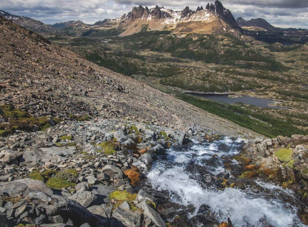
Cascadas / Ríos
Flora
Bosques
Panorámicas / Paisaje
Apto para niños menores de 10 años
Difficulty:
I did it

Hiking routes
CIRCUITO LAS CHILCAS
Antuco
Author: Joaquin Muñoz
Introduction
Nestled in the Parque Nacional Laguna del Laja, the beautiful route of Las Chilcas is an excellent choice for those who enjoy learning about diverse types of flora and fauna. The existence of such a rich natural diversity in a small area where the volcanic scenery contrasts greatly with the marvellous greenery of a forest made up of species such as radal enano (Orites myrtoidea), crucero (Colletia spinosissima), quinchamalí (Quinchamalium chilense), ciprés de la cordillera (Austrocedrus chilensis) and of course abundant chilcos (Fuchsia magellanica) which give their name to the route. All of these plants make this route an excellent option for those visiting this protected area. Furthermore, the trail leads between viewpoints where visitors have a wonderful view of great courses of water and which add even more attraction to the route. The trail, which is almost unperceivable from the Pichachén international pass, can be completed in less than 2h.
Appropriate season
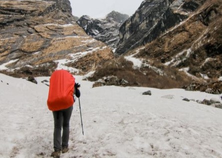
All year round. The best time to visit is spring and summer as you will be able to see the vegetation in all its splendour. Autumn is also a surprising time to visit the park, with the warm tones of the changing leaves adding to the charm. In winter it is possible to walk along the route which can be covered in snow, and can be a unique experience for those who are less experienced in walking through snow.
Access
The closest town to this route is Los Ángeles. See here how to reach Los Ángeles.
From the town of Los Ángeles it is 101km to the Antuco ski centre along route Q-45. After 97km you will enter the Parque Nacional Laguna del Laja where the Conaf guard post is located beside the park entrance See photo 1. Here you will need to register and advise them of the route you will complete as well as pay the entrance fee (CLP$1200 p/p, approx. USD$2). The road is paved until Abanico (84km) and then it gravelled and in good condition.
If you are coming from the north, you can follow route O-97 (paved) which starts near to Cabrero and leads southeast towards Huepil. From Huepil you can continue along this route until reaching Abanico, the majority of this route is along gravelled road. If you want to avoid the gravel, you can turn south at Huepil and take route Q-45.
You can leave your car in the car park located just at the start of the route 2.7km after the guard post at the entrance to the park See photo 2.
There is no public transport to the start of the route.
Permits / Prices
The entry fees to the Parque Nacional Laguna Laja are as follows: adult CLP$1200 (approx. US$2), children CLP$600 (approx. US$1). Saturdays, Sundays and holidays CLP$3000 (approx. USD$5) for private transport.
Accommodation / Facilities
There is a Conaf campsite in the park. Outside the park there are other options including cabins and campsites.
Recommendations
- The seasons in Antuco are marked: in winter there can be puelche (wind from the east), so the wind chill factor makes it seem a few degrees colder whilst in summer it can be extremely hot.
- If you are visiting with small children it is advisable to keep them close as even though the perimeter of the waterfalls are closed, letting them wander can be dangerous.
- Do not light fires, smoke and take all your rubbish with you. Ensure that you leave this beautiful area in the same state as you found it.
- There are wooden bridges installed along the route. When these are wet they can becomes extremely slippery so it is advisable that you use appropriate footwear and walk carefully other these parts.
- If you are observant, you may be able to see various species of fauna and glimpse condors in the distance who nest near the route See photo 15.
- You can get drinking water from the Conaf guard post.
Gear
- Trekking boots
- Trekking poles
- Warm clothing in winter
- Sun protection
Schedule
- Antuco – Las Chilcas route - Antuco


Comments
Circuito Las Chilcas
Joaquin Muñoz 30/08/2015
Punto alcanzado: Circuito completo
Fecha expedición: 27/06/2015
El sendero es bastante interesante pues en un espacio reducido posee una gran bio diversidad. Tiene un muy buen acceso y es bastante marcado, lo que lo hace un sendero apto para toda la familia. Totalmente recomendable.
Tracks and Waypoints
Circuito Las Chilcas
Circuito Las Chilcas
Colaborador: Daniel Perez
Fecha: 05/09/2015

I did it!