Summary
General Information
Quebrada Jorquera
Country: Chile
Region: Región Metropolitana
Area: Reserva Nacional Río Clarillo
Nearest city: Santiago
Number of journeys: 1
Total distance: 0,87km
Trail Markings: Frecuente y clara
Trail: Claro y marcado
Route type: Circuito
Fauna
Flora
Bosques
Panorámicas / Paisaje
Señal de celular
Apto para niños menores de 10 años
Difficulty:
I did it

Hiking routes
QUEBRADA JORQUERA
Reserva Nacional Río Clarillo
Author: Daniel Perez (CL).
Introduction
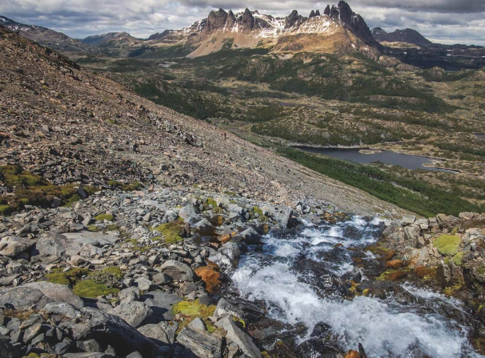
Among the routes in the Reserva Nacional Río Clarillo, on one of its slopes facing north, a trail ascends alongside the Jorquera ravine to one of the viewpoints over the canyon. To make the 1000m route more interesting and informative, information boards have been installed along the route showing the flora present in the region, principally the trees in the sclerophyll forest. The species found the in reserve include: Peumo or Chilean acorn (Cryptocarya alba), soap bark tree (Quillaja saponaria), lingue (Persea lingue), canelo (Drimys winteri) and types of guayacán. When the forest opens up just before the viewpoint over the valley, you will also come across litre (Lithraea caustica) and various types of cactus and chagual (Puya chilensis). The final viewpoint has been constructed a few metres above the ground and offers spectacular views of the mountain range, the Santiago valley and the canyon etched out by the River Clarillo.
The trail is located in Reserva Nacional Río Clarillo in the Metropolitan Region of Chile. It is thought that the reserve is very similar to how Santiago was in its natural state, drawing a parallel between the River Mapocho and River Clarillo. At the time of publication (July 2015), this protected area was in the process of becoming a national park, which would make it the first of its kind in the Metropolitan Region.
Appropriate season
All year around.
Access
From Santiago, head southeast to the village of Pirque which is some 40km away. See directions to Pirque on Google Maps. From Pirque, continue southeast for a little more than 5km until reaching the sector called El Principal. From here, follow route G-405 heading east. You will see various signs showing the way to the Reserva Nacional Río Clarillo, but if you get lost you can ask the locals for directions. After continuing for nearly 2.5km you will reach a dirt track (suitable for all vehicles) where there is a large sign marking the entrance to the reserve. Follow this road for 3.5km until arriving at the entrance to Reserva Nacional Rio Clarillo, where you will have to pay the entrance fee. Continue driving for a little more than 500m until reaching the second car park on the left hand side (north). The trail is located beside the car park, and there is a sign marking the start.
Permits / Prices
The entry fees to the reserve are as follows: adult CLP$3000 (approx. US$3), children between 6 and 17 years old CLP$1000 (approx. US$2), men over 65 years and women over 60 years old CLP$1000 (approx. US$2).
Accommodation / Facilities
There are numerous picnic areas and toilets in the Reserva Nacional Río Clarillo. It is forbidden to camp in the reserve but there is a campsite just outside the boundaries.
Recommendations
- There is no drinking water available along the route.
- If you have enough time, we recommend that you complete the Arboretum route which begins at the same car park described in the Approach. As well as this route, there are also nearby trails including Aliwen Mahuida and Trikau.
Gear
- Trainers
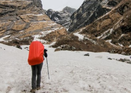
- Warm clothing (during winter)
Schedule
- Santiago – Jorquera Ravine - Santiago


Comments
Quebrada Jorquera
René Pérez Hernández 31/08/2022
Other excursionists: Leslie infante ( les17 )
Fecha expedición: 27/08/2022
Daniel Perez 02/07/2015
Punto alcanzado: Mirador
Fecha expedición: 27/06/2015
Bonita ruta dentro de la Reserva Nacional Río Clarillo, que permite ver bosques nativos, que día a día escasean más en la RM. Si se tiene más tiempo se puede complementar la visita a la reserva con los otros senderos del sector. Totalmente recomendado.

I did it!