Summary
General Information
Serranía del Ciprés
Country: Chile
Region: Región de Valparaíso
Area: El Asiento
Nearest city: San Felipe
Number of journeys: 1
Total distance: 5km (sólo ida)
Trail Markings: Esporádica
Trail: Claro y marcado
Route type: Ida y vuelta
Flora
Bosques
Transporte público
Señal de celular
Apto para niños menores de 10 años
Difficulty:
I did it
Hiking routes
SERRANÍA DEL CIPRÉS
El Asiento
Author: David Valdés
Introduction
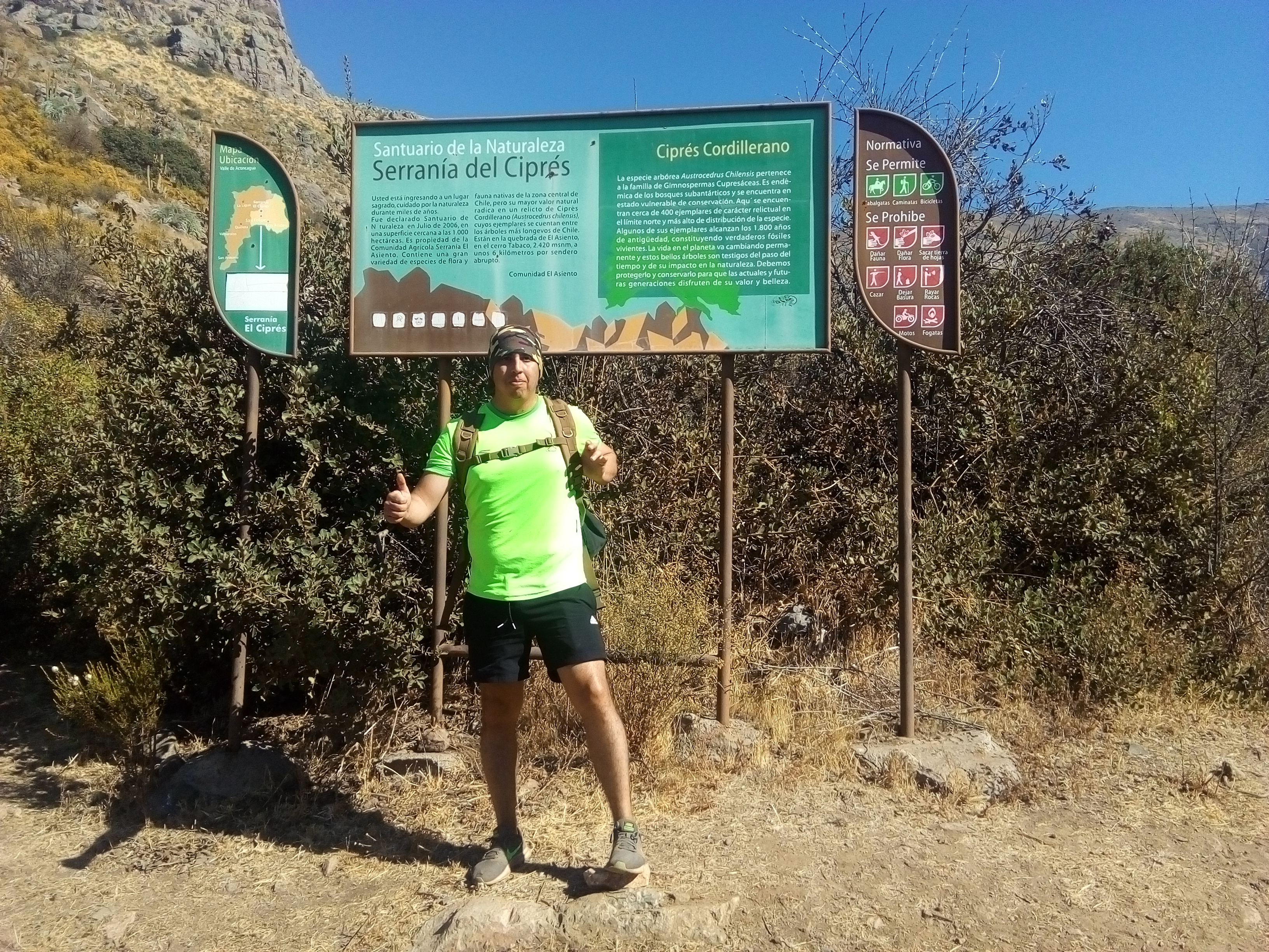
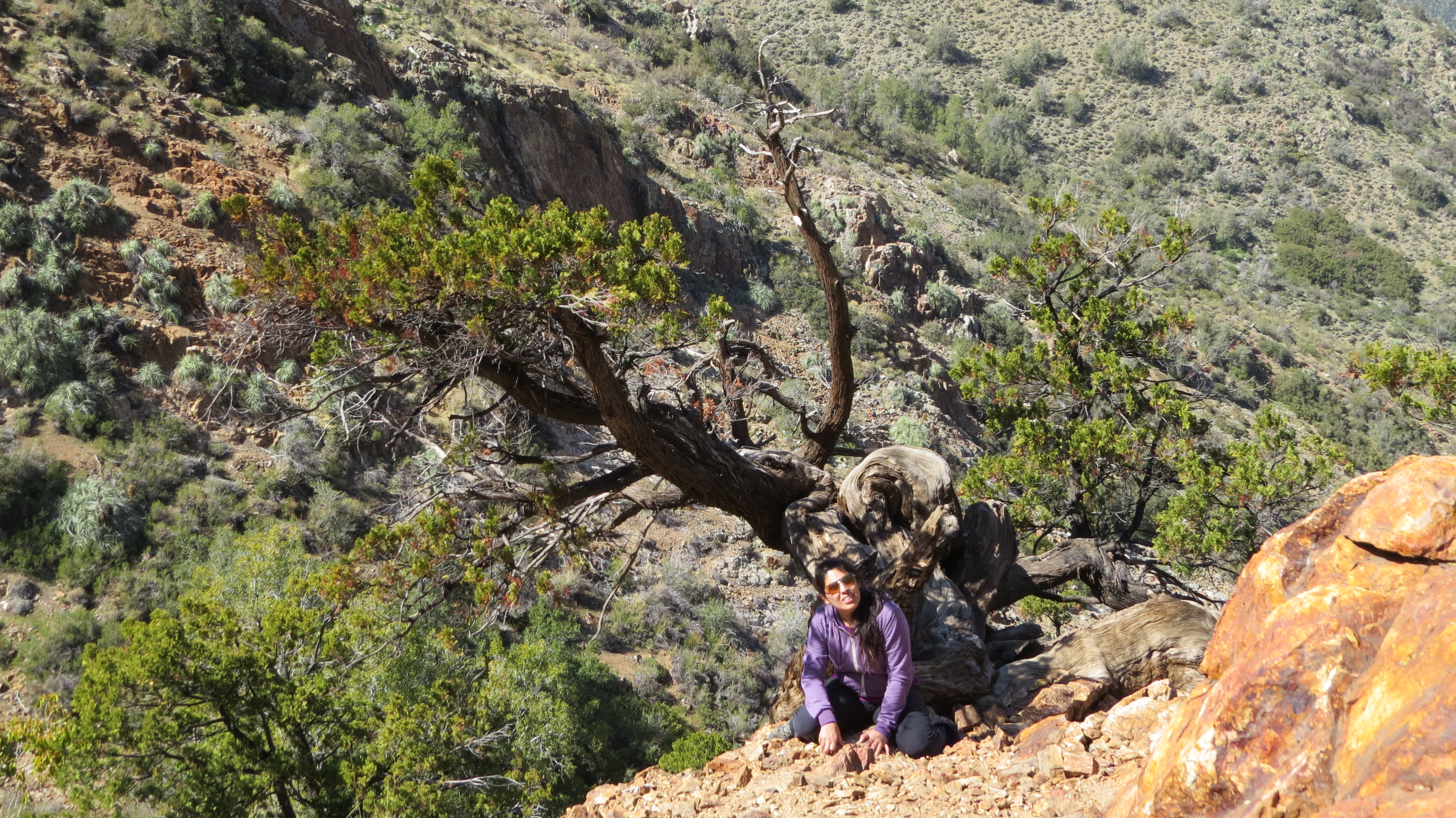
Serranía del Ciprés is a property some 1,000 hectares in área which was named “Santuario de la Naturaleza” (Nature Sanctuary) in 2006. It is located at the foot of Cerro Tabaco and is owned by the Serranía El Asiento community. This sanctuary protects a great variety of flora and fauna native to Chile’s central zone, but its principal value is the forest which has more than 400 specimens of cordilleran cypress (austrocedrus chilensis), the most northern species in Chile. Some of the trees are up to 1,800 years old.
Appropriate season
From autumn to the start of spring. Although it is possible to complete the route during summer, it is not the most agreeable period due to the high temperatures in the area.
Access
From San Felipe (km 0) follow route E-71 northwards towards the village of Putaendo. After just 3km you will reach the 21 de Mayo Bridge over the River Putaendo, and then you will enter the sector El Asiento. At this point, turn west (left), cross the bridge and continue straight along this route (paved). After 5.4km you will cross the River Las Minillas (generally dry) via a ditch. Once you have continued 6.4km, you will reach a fork in the road. Continue left (southwest).
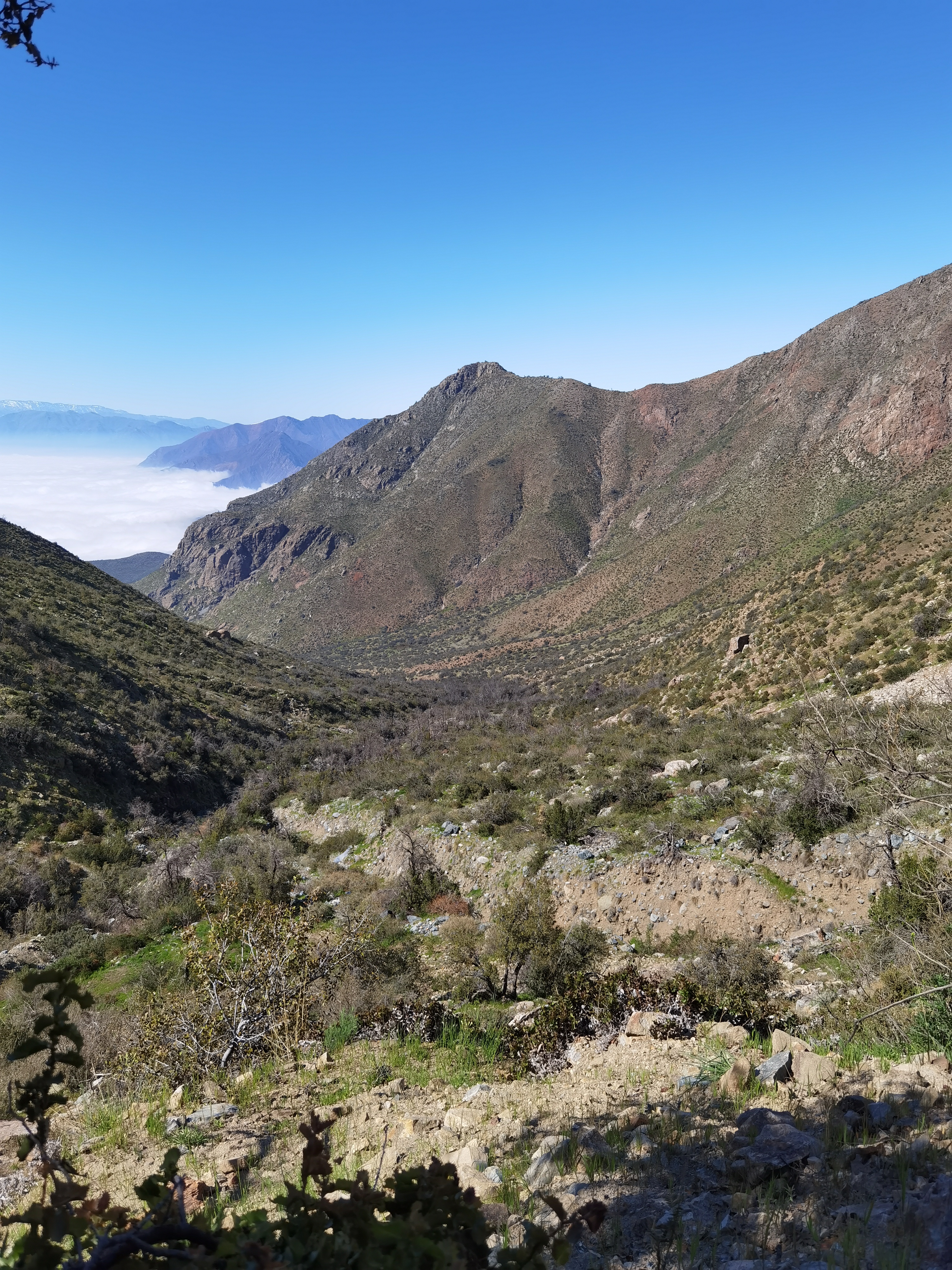
From the fork, the road going onwards is a dirt track. Continue for approx. 1.2km until taking a turning to the north (right) just after an abandoned building site See photo 1. This new track is in very bad condition covered in rocks, ruts and potholes. Even though it is not necessary to pass in a 4x4, we recommend that you use a taller car. Follow the track for 2.7km from the abandoned construction site until you reach the entrance to the Sanctuary.
The dirt track continues for a short while into the Sanctuary, but it is not recommended that you continue along it given that its conditions become considerably worse making it almost impossible to continue without four-wheel drive. There is enough space to turn and park your car at the entrance to the Sanctuary. From San Felipe it is approx. 10.2km to the entrance.
To see the access from San Felipe to the abandoned construction site, go to Google maps.
Permits / Prices
You do not need to pay entrance fees or ask for a permit to enter the park.
Accommodation / Facilities
None.
Recommendations
- There is no drinking water available along the route. Make sure to take enough with you.
- After the paved road, the route becomes gradually worse. A 4x4 is not necessary, but we do recommend that you go in a taller car.
- Given that there are no toilets or waste bins in the Sanctuary, ensure that you look after the environment as best as possible and dispose of your rubbish at authorised points.
Gear
- Trekking poles.
- Trekking boots or high-ankle boots.
- Windbreaker.
- Sun hat, sun protection.
- Water (bottle, canteen, camelback, etc.)
Schedule
- San Felipe - Serranía del Ciprés - San Felipe
Comments
Serranía del Ciprés
Alexander velarde 02/10/2023
Punto alcanzado: 1900 msnm
Fecha expedición: 01/10/2023
Una muy bonita ruta, en recuperación, pero no deja de ser una buena oportunidad para conocer este bello lugar.
José Mena María Paz Opazo 26/08/2023
Punto alcanzado: Letrero a la altura del primer ciprés
Fecha expedición: 26/08/2023
Tuvimos que caminar desde las construcciones abandonadas (señaladas en la descripción de la ruta) ya que nuestro auto no era apto para el camino, además que había una barrera con candado en el camino que sigue hacia la mina.

Fue una impactante sorpresa encontrarnos con gran parte del bosque quemado (no los cipreses sino que la zona más abajo, esclerófilo). Se observan muchos renovales, ojalá que el lugar pueda recuperar dentro de poco la biodiversidad que lo caracterizaba. Con todo, una excursión interesante, pero bastante más larga que lo descrito. Desde las construcciones abandonadas calcular unas 4 horas de caminata hasta la parte alta del bosque de cipreses .
luis Toledo 13/04/2018
Punto alcanzado: Santuario
Fecha expedición: 13/04/2018
Es un Santuario Maravilloso.
Caro Reyes 27/01/2016
Punto alcanzado: Hasta los cipreses
Fecha expedición: 23/11/2015
Hay que Pedir permiso ya que es un parque privado
David Valdés 16/11/2015
Punto alcanzado: cipreses
Fecha expedición: 19/07/2014
Es realmente increíble este lugar. Esperaba encontrarme con pequeños ejemplares con poca vida, pero la sorpresa fue diametralmente distinta: enormes árboles robustos de decenas de años. Un gran paseo.




I did it!