Summary
General Information
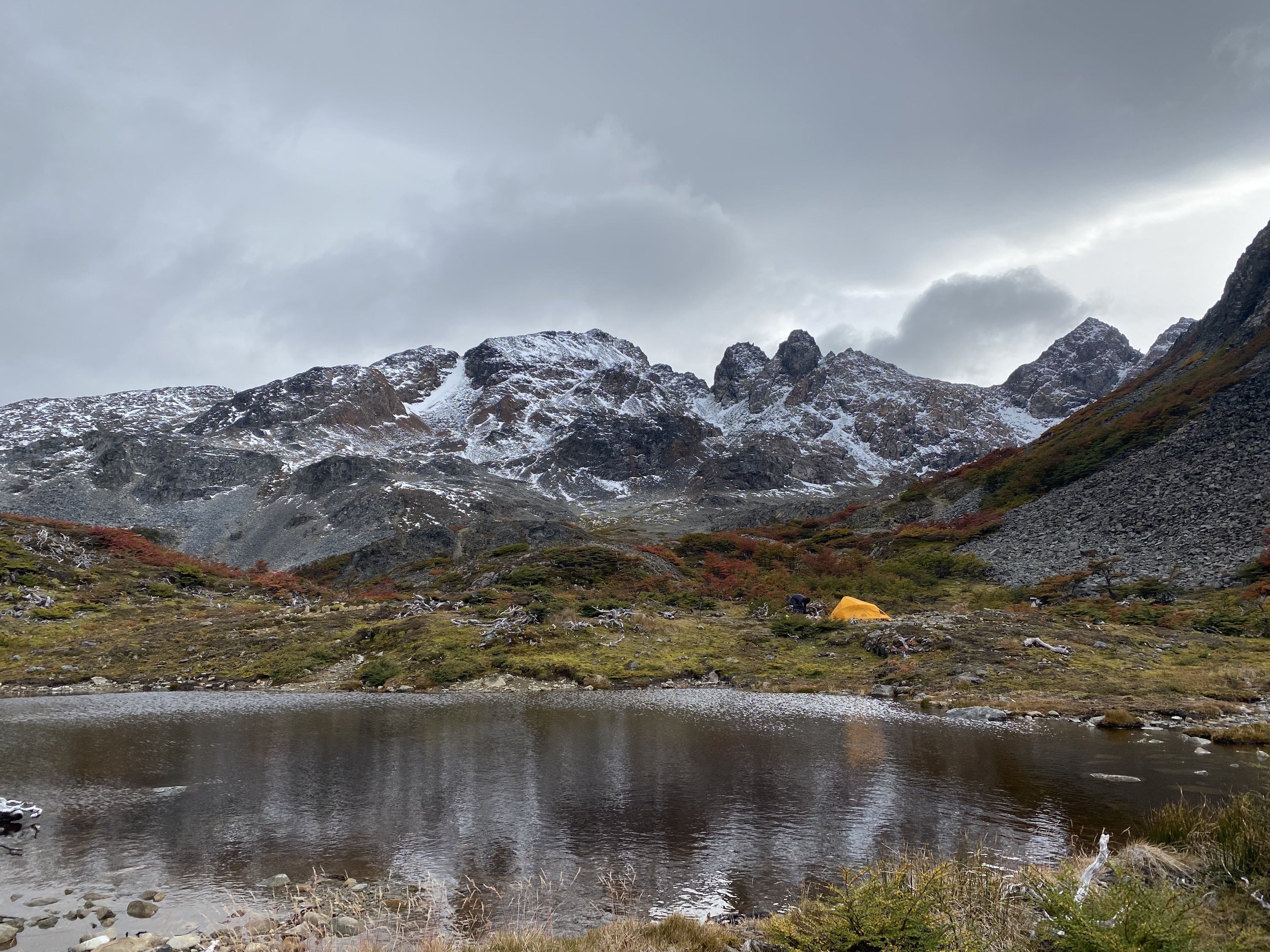
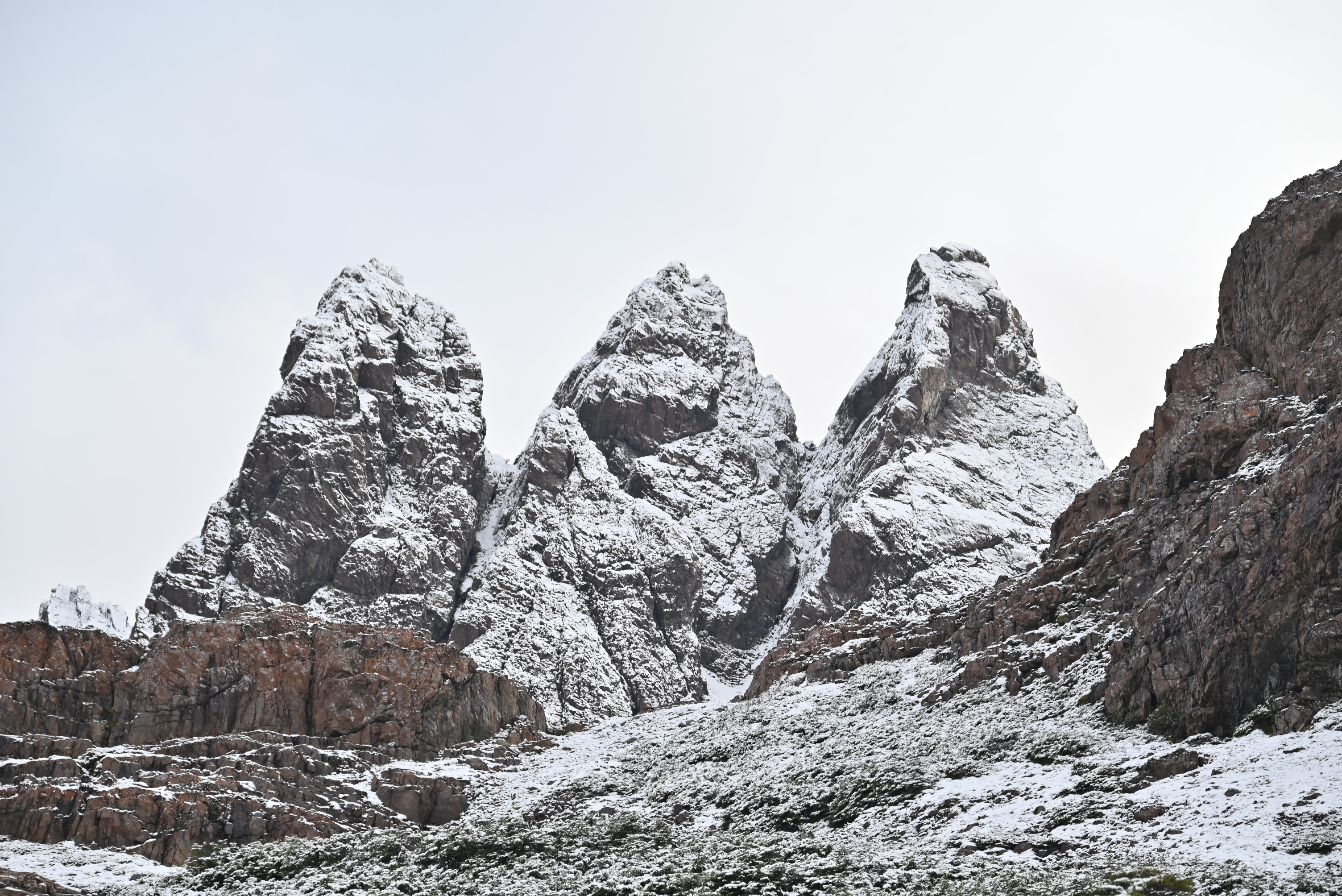
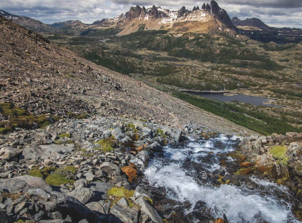
Dientes de Navarino
Country: Chile
Region: Región de Magallanes
Area: Isla Navarino
Nearest city: Puerto Williams
Number of journeys: 5
Total distance: 50km
Trail Markings: Esporádica
Trail: Poco marcado y/o intermitente
Route type: Circuito
Fauna
Cascadas / Ríos
Flora
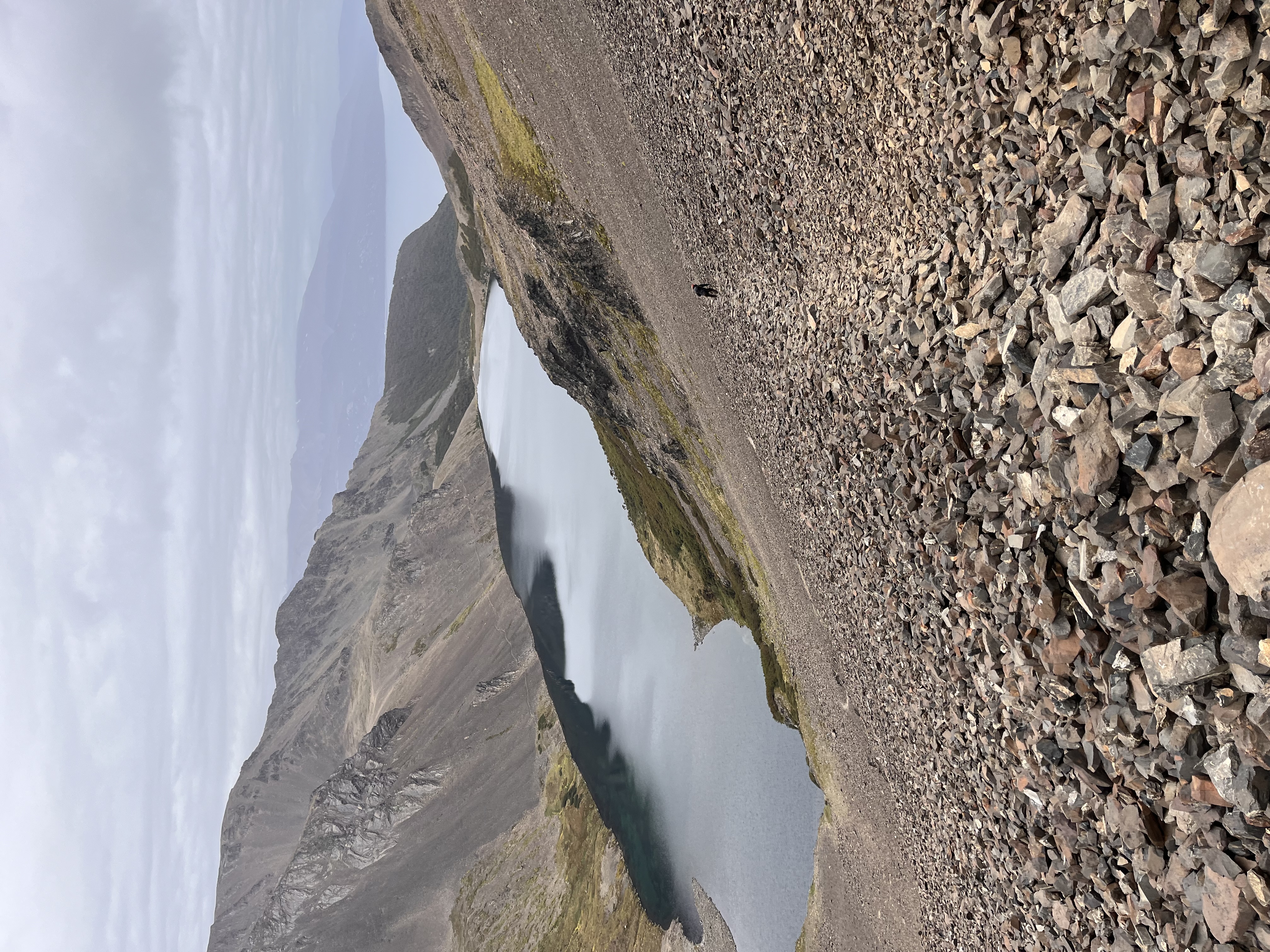
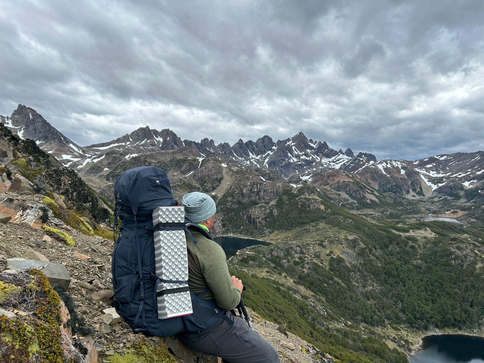
Lagos / Lagunas
Ruta con cumbre
Bosques
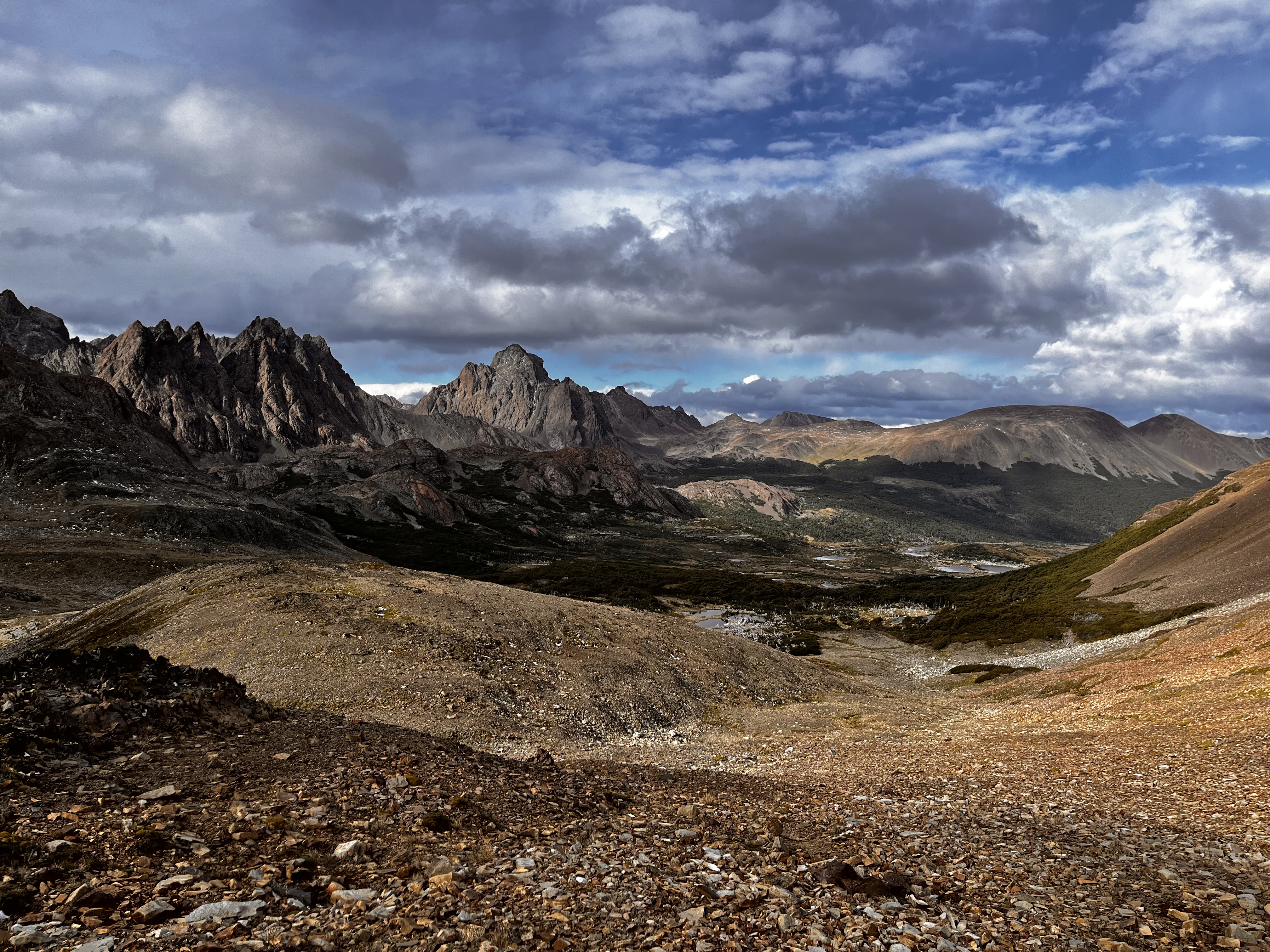
Panorámicas / Paisaje
Difficulty:
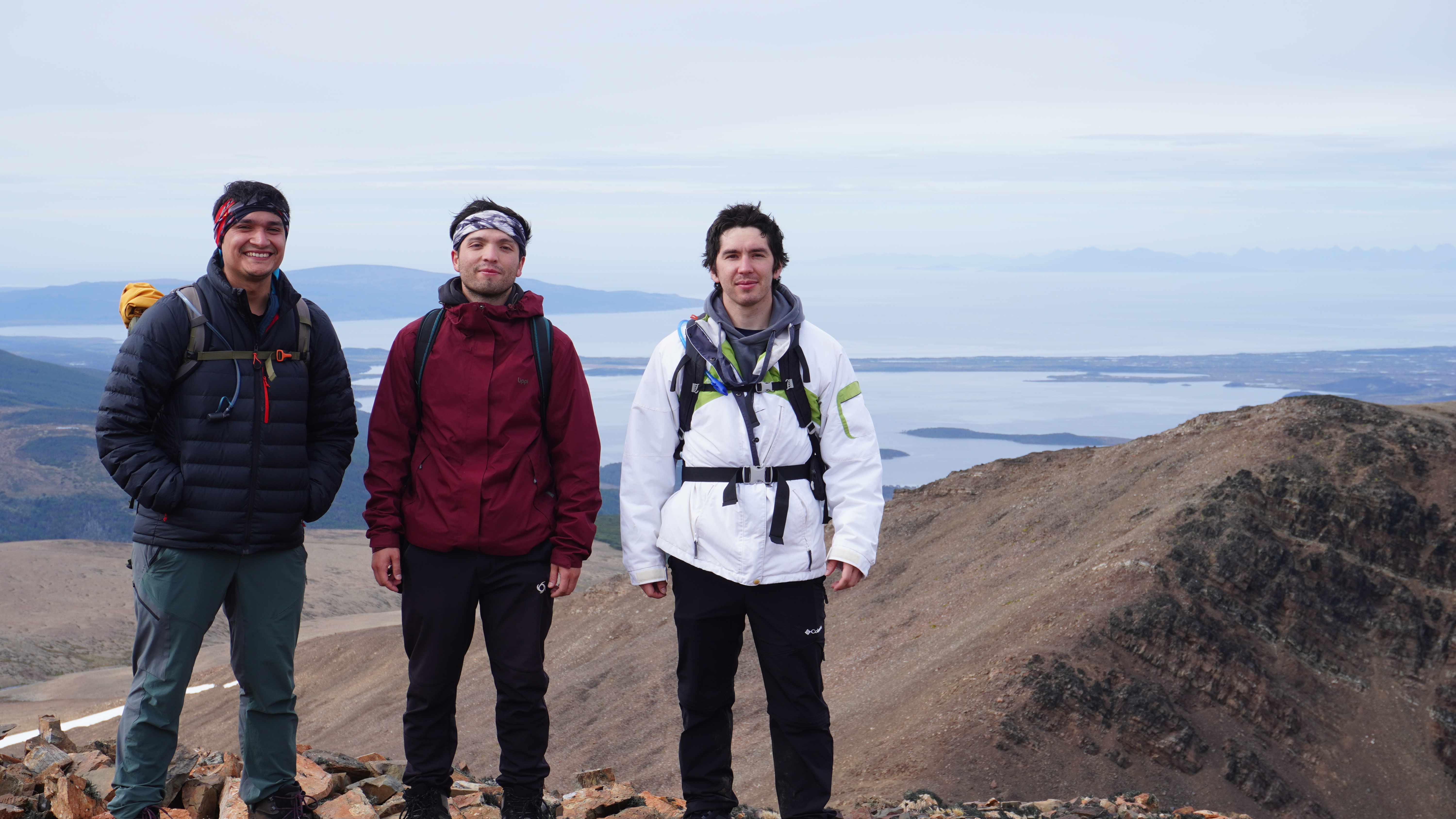
I did it

Hiking routes
DIENTES DE NAVARINO
Isla Navarino
Author: Daniela Quiroz Olguín (CL).


Introduction
Navarino Island can be found to the south of the Beagle Channel and is one of the three islands that make up the commune of Cape Horn. The Dientes de Navarino circuit is located on this island, which received its name due to the mountain range that surrounds the whole route. Trekking lovers from all over the whole come year after year to walk this route, attracted to the region due it being one of the most southern and pristine locations on earth. In 2001, el Ministerio de Bienes Nacionales (Chilean Ministry of National Heritage) completed the task of marking the route with the aim to widen the range of visitors to the island. Furthermore, in 2005 UNESCO created the Cape Horn Biosphere Reserve due to the beautiful scenery on the island, in which this national route can be found. This Biosphere Reserve is the first of its kind in Chile to include areas outside of protected zones. The Dientes de Navarino route falls into this category – it is located within the Biopshere Reserve but not within the Cape Horn National Park. The route marked by 38 checkpoints that correspond to signs indicated by el Ministerio de Bienes Nacionales. Such points are shown by signs, rocks, marks on trees, etc., which not only let hikers complete the walk independently, but also point out relevant sites, such as routes, viewpoints, campsites, etc.).
To start this trail, you will need to travel the 2500km from Santiago to get to the town of Puerto Williams, located on the northern coast of Navarino Island. The town was founded at the end of the 19th Century, when settlers arrived, attracted by the Gold Rush caused by the deposits found in Puerto Toro, on the eastern side of the island. Thereafter, the State began to encourage the breeding of livestock which brought some hundred more settlers to the area, who founded Puerto Luisa on the 21st November 1953, whose name was changed just three years later to Puerto Williams after the Irish sailor John Williams who was the founder of the fort Fuerte Bulnes by the Strait of Magellan (1842). Puerto Williams currently has a population of around 2000 inhabitants, of which only 35% are civilians and the rest being linked to the Armed Forces. This is due to the town’s strategic position between the Atlantic and Pacific oceans, as well as its proximity to the Chilean territory in the Antarctic. The island is neighboured by the islets Nueva, Picton and Lennox, which were the main reason for the dispute between Chile and Argentina in 1978 where armed conflict was only just avoided due to papal intervention.
There are a number of other routes near to Dientes de Navarino that can be completed: the Wulaia route and the Lago Windhond route. It should be mentioned that along all three of these routes, you will be able to see the effect that beavers have had on the landscape, an introduced species from Canada that were brought to the region due the fur industry in the 1930s in Ushuaia, from where the animals escaped and then crossed to the neighbouring island of Navarino. Since 2001, which was the first time that these mammals were seen on the island, the population of this species has grown exponentially as there are no natural predators to contain their numbers. The beavers have changed the landscapes by felling trees, creating dams, flooding and destroying the Magellan woodland, and they are endangering the indigenous flora and fauna of the island.
Appropriate season
The best time of year to complete this trek is between December and February, when the days are longer and the temperatures are higher. Even during this period, you will still need to be prepared for the cold, wind, rain and snow.
Access
From Punta Arenas
From Punta Arenas there are two options for getting to Puerto Williams:
- By air: you will need to take a plane with DAP Airways, which you will need to book by directly contacting the company via email [email protected] or via telephone 61 2616100 (Punta Arenas). The cost of a return plane ticket is approx. CLP$ 143000 (~US$ 228), and the journey takes from 35 minutes to 1 ½ hours depending on the condition of the plane and the weather at the time. The flights leave daily from Monday to Saturday. The inhabitants of the town Puerto Williams are given three return tickets each year by the government.
- By sea: from Punta Arenas it is possible to take a ferry with the Transbordadora Austral Broom S.A. which takes around 30 hours to Puerto Williams. This beautiful journey will take you through the Patagonian fjords and the Beagle Channel. The prices are $98000 (~US$ 156) semi-cama (“half-bed”; semi luxury) y $137000 (~US$ 219) cama (“bed”; luxury) with discounted prices from children between 2 and 10 years old. There are just four journeys each month, generally departing from Punta Arenas on Thursday at 18:00, and return from Puerto Williams on Saturday at 16:00, apart from the last week of the month when the first leg of the journey departs on Sunday.
From Ushuaia
There is a boat operated by the Argentinian company Ushuaia Boting which makes the crossing from Ushuaia in about 30 minutes. You will then need to take the bus to Puerto Williams. The journey from Ushuaia leaves daily from December to February subject to weather conditions which cause the cancellation rate of this service to be relatively high. Contact [email protected] or [email protected].
Permits / Prices
You will need to advise the police in Puerto Williams of your departure.
Accommodation / Facilities
There is no accommodation or amenities.
Recommendations
- It is important to book the plane tickets in advance, especially in January and February, due to popular demand during the peak season. What’s more, there are currently lots of construction work being completed in Puerto Williams, and the workers are taking up a great deal of the available tickets.
- Remember that in Puerto Williams it is forbidden to ask for plastic bottles from the grocery stores.
- The maximum weight of luggage on the plane is 10kg, so to avoid paying more for overweight bags it is advisable to stock up on food in Puerto Williams. Due to the complicated access to the area there are no air taxes, hence the prices not being extremely high.
- It is possible to find gas in Puerto Williams, in a hardware store in Plaza de Armas, and also in the shop Wulaia Expediciones.
- On the last Sunday of every month there is a ferry that goes from Puerto Natales to Puerto Toro, a small village on the south-eastern side of the island, to bring supplies to the zone and to take their rubbish away. If the dates are suitable, it is possible to take the ferry for free, by signing up in the municipality of Cape Horn, located on the street calle O’Higgins #186, Puerto Williams, or by emailing [email protected].
- There is free Wi-Fi for all tourists and locals in the library in Puerto Williams.
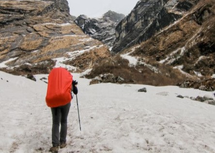
Gear
- Use of GPS, map and compass.
- Trekking poles.
- All type of water protection. You will cross many rivers, meadows and peats, so it is almost impossible not to get wet.
- Mountain clothing and equipment. Warm, water and wind resistant.
- Water resistant footwear or a spare pair.
- Thermal wear is absolutely necessary.
Schedule
- Puerto Williams - Laguna del Salto
- Laguna del Salto - Laguna Escondida
- Laguna Escondida - Laguna Martillo
- Laguna Martillo - Laguna Los Guanacos
- Laguna Los Guanacos - Puerto Williams


Comments
Dientes de Navarino
Sebastian Widow 22/03/2024
Punto alcanzado: Pasó Virginia 850mts
Fecha expedición: 15/03/2024
Ruta muy hermosa pero los tramos más complejos no están bien señalados así que se recomienda el GPS, el final de la ruta pasado el Lago Guanacos ha variado bastante a la del mapa debido a los árboles caídos por los castores.
fabian ramirez 16/02/2024
Punto alcanzado: Pasó Virginia (860 msnm)
Fecha expedición: 15/02/2024
Maravilloso Trekking, sin embargo es de dificultad alta. La huella se pierde con facilidad, así que se hace obligatorio el uso de GPS. Importante llevar bolsa seca ya que puede haber lluvia, viento y frío incluso en verano.
Ignacio Sepúlveda Figueroa 04/03/2025
Other excursionists: Agustín Fuentes Muñoz, José Luis Espinoza
Punto alcanzado: Lago Windhond
Fecha expedición: 28/01/2024
Como si fuera un personaje de la novela de Tolkien se disfrutó esta excursión de 5 días junto a dos grandes amigos que apañaron durante todo el recorrido. Iniciamos el domingo 28 de enero del 2024 atravesando el Cerro Bandera, laguna del Salto, del Paso, de Picacho, Monte Bettinelli, Lago Windhond, laguna de los dientes, laguna Martillo, Paso Virginia, Laguna de los Guanacos y tantos otros cerros y lagunas sin nombre, muchas de estas construidas por castores invasores.
Felipe Patagon 05/01/2024
Punto alcanzado: Paso Virginia
Fecha expedición: 05/01/2024
Hermoso circuito, lo hicimos en 5 días tranquilamente y disfrutamos cada paso.
Marcelo Venegas Alsina 23/03/2023
Other excursionists: Sebastián Parra
Punto alcanzado: Paso Virginia
Fecha expedición: 17/03/2023
Trekking de 4-6 días dependiendo de las condiciones climáticas y condición física
Tracks and Waypoints
Dientes de Navarino
Colaborador: David Valdés
Fecha: 06/06/2015
Dientes de Navarino + Lago Windhond
Colaborador: Bitacorasdeviaje.cl -
Fecha: 17/09/2015
Les dejo acá el track de esta maravilosa ruta, para cmplemetarlo con el del lago windhond, que si bien no esta descrito, bien vale la pena realizar

I did it!