Summary
General Information
Glaciar Leones
Country: Chile
Region: Región de Aysén
Area: Glaciar Leones
Nearest city: Coyhaique
Number of journeys: 1
Total distance: 9,4km (sólo ida)
Trail Markings: Esporádica
Trail: Claro y marcado
Route type: Ida y vuelta
Fauna
Glaciares
Cascadas / Ríos
Flora
Lagos / Lagunas
Bosques
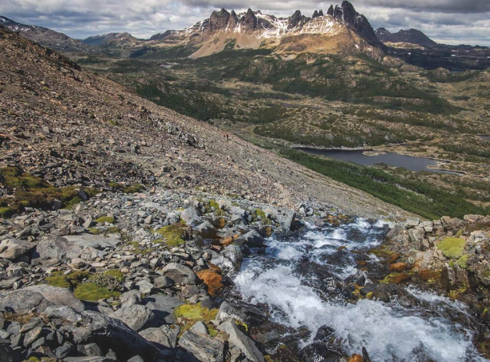
Panorámicas / Paisaje
Difficulty:
I did it

Hiking routes
GLACIAR LEONES
Glaciar Leones
Author: Paulo Cox
Introduction
“What a marvellous sight is the series of summits and turrets which stand in line to the south of Monte San Valentin and which would become our friends! Between them, forming veritable garlands are the pristine fields of hardened snow that make up the Patagonian Ice Field. It makes an intercontinental barrier between the ices, the divortium glaciarum. Along the sides the hanging glaciers flow, and together they plunge into the waters of Lake León.”
“Hess described excitedly the marvellous hanging glaciers and mountains in the zone, “which are more than comparable to the Alps”. For him it was the most beautiful sight he had ever beheld.”
Arnold Heim, 1953.
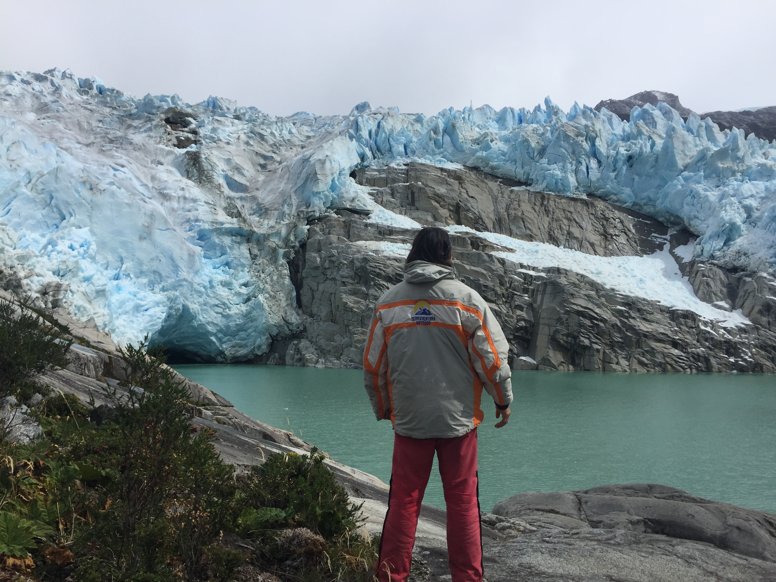
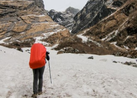
This excursion has its prima donna, this being without doubt the Leones Hanging Glacier. Located at the end of the valley which connects Lake Leones with Lake General Carrera to the east via a river by the same name, this shining glacier contrasts greatly with the turquoise waters of the lake it feeds. It stands a thousand metres about the surface of the water, between sharp granite bastions and the menacing and imposing ices which break off from the great glacial plateau that it the Northern Patagonian Ice Field. On hitting the surface of the lake, the massive chunks of ice produce a deafening noise which, from a distance, could be mistaken for a lion’s roar. Even if this could have been the reason behind the glacier’s name, it is more likely to be due to the large population of pumas in the zone, especially in the highest sector of the valley, and being the namesake for the valley, lake, river and glacier. The Leones Hanging Glacier is only visible right at the end of the approach, which increases both the suspense during the trail and the awe once you finally reach it.
Besides the main attraction, the hanging glacier, this trail stands out for combining both travel via boat and on foot; as well as the River Leones’ striking contrast, firstly you will see its gentle and meandering green waters and then you will witness its force at the tumultuous draining from Lake Leones. A little further on this river is ambushed by the white foaming water of the River Fiero which descends from the northwest.
The route to the Leones Hanging Glacier has a gentle ascent (with a net altitude gained of just 140m, uniformly distributed along the trail) and leads almost straight over a wide sedimentary plain, and old riverbed by the same name. Approximately 9km in distance, the route is divided clearly into thirds with each being 1h long: the first leg leads over private property with sections of reforestation, and areas with large rocks, pampa and forest; the second leg begins at the stream El Pedregal, on the border with the next property to the west, and crosses wetter pampa, forest, and leads near to the River Leones, and then leads over a section with small hills; the third part crosses a wide and rocky plain, this one being drier and covered in thinner and lower vegetation and finally arrives at the eastern shore of Lake Leones.
Even though the trail is not signposted, the high summits on either sides and at the end of the valley as well as the low growing thinner vegetation (partly due to the burning of native woodland in the valley by humans in the past) and short sections of forest mean that it is not difficult to find you way, even in areas where the path is not all that clear.
Due to it being unobstructed, with easy access and its location being between main towns on the tourist circuit which follows the irregular form of the shore of Lake General Carrera to the west, between Puerto Río Tranquilo and Puerto Guadal, this excursion is not physically or technically demanding and does not require skills in orientation. For these reasons it is the perfect option for a daytrip for people with a wide range of abilities, especially those who are looking for a more authentic Patagonian adventure.
This trail is also interesting from a purely historic point of view. The route is very similar to the expedition completed in this sector by the Swiss geologist Arnold Heim and his team in December 1939 and December 1945. Following the footsteps of Federico Reichert, one of the fathers of modern mountain climbing, Heim’s expeditions opened the access to the Northern Patagonian Ice Field from the west. Although Heim did not manage to reach the summit of the mountain San Valentín which was his main objective, his explorations and notes have been of use to contemporary explorers who wish to reach the Northern Patagonian Ice Field and this mountain up until today.
Notes
The citations were taken from "Un geólogo Suizo en la Cuenca del Lago Buenos Aires/General Carrera", de Wolfang Staub and Fresia Barrientos, 2009, which is an extract and investigation of the book “"Sudamérica, vivencias en la naturaleza de Chile, Argentina y Bolivia" by Arnold Heim, published in German 1953. The book by Staub and Barrientos is available in the librería Glaciares.
The author is grateful to the valuable information given by Pascual Díaz in the preparation and description of this route. Any error is the exclusive responsibility of the author.
Appropriate season
Between December and March, at the height of summer. In this period the temperatures are higher and the days longer (in summer at this latitude there is still enough light at 9:00pm). In spite of this, these southern regions close to the Pacific Ocean have an extremely unstable climate which can be unpredictable even during one day and throughout one week.
The excursion can be completed all year round, but in this case you will have to start earlier and complete it quicker than usual, taking advantage of the little light during notoriously short days. The short days also allow for less time at the glacier. Furthermore, bad weather can make the journey to the glacier extremely difficult for excursionists due to low temperatures and the wind chill factor, especially when your clothes and equipment become wet.
Access
Private transport
Depending on where you choose as a starting point for this route, you will need to follow the Carretera Austral to Puerto Río Tranquilo or to Puerto Guadal. From Coyhaique follow the Carretera Austral (route 7) heading southeast towards Balmaceda (55km from Coyhaique). A little before reaching Balmaceda, approximately 39km from Coyhaique (approx. 16km to the west of Balmaceda), turn to the right and continue along the Carretera Austral (route 7) to the south (turning located a few kilometres after the village El Blanco).
Continue south along route 7, which is paved and in good condition, until reaching Villa Cerro Castillo (94km from Coyhaique, 1h; 55km from the turning after El Blanco). In Villa Cerro Castillo, follow the Carretera Austral south, this leg is gravelled and winding. From Cerro Castillo it is 122km (218km from Coyhaique) to Puerto Río Tranquilo and 181km to Puerto Guadal (59km, approx. 1h from Río Tranquilo).
To reach the valley Valle de Leones from Puerto Río Tranquilo, follow the Carretera Austral until you reach the bridge crossing the River Leones (approx. 25km, ½h), which descends from the west and hundreds of metres below flows into Lake General Carrera. Cross the bridge to the southern bank of the river and some 300m after the bridge follow the private dirt road leading east, entering the valley via the southern bank of the river. There is no sign marking the access point, so you should be alert for this turning after having crossed the River Leones.
Alternatively, from Puerto Guadal follow the Carretera Austral heading north until reaching the bridge over the River Leones to the north (34km; approx. 40min). A little before reaching the river (300m), turn onto the dirt road (described previously) which is located by a group of small houses on the left hand side (west).
From the turning onto the private road, it is approx. 12km along the badly maintained dirt road to the start of the trail (approx. 1h from the Carretera Austral), after crossing various flooded dips and bogs and after opening and closing 6 gates (unlocked) dividing areas of private property. Even though the most part of the road is suitable for any type of vehicle, it may be necessary to travel in a 4x4 vehicle. From the River Leones bridge there is no public transport to the valley. You can hire transport services with guided expeditions mentioned below. Another option is to walk the leg from the Carretera Austral (this should take an extra 3h).
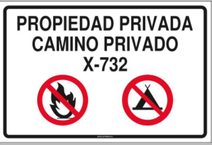
After approx. 12km you will reach a chain which stops you from continuing by vehicle any further, alongside various signs marking the entrance to Pichimahuida Private Park, owned by Australians Elena Sobakina and John Whitelaw (190m, See photo 1). Almost a third of the route is over this property. Here is where you must leave your car. There is enough space to park on the side of the road.
If you travel via private transport, be aware that from Coyhaique the next petrol station is Puerto Río Tranquilo (218km). Puerto Guadal also has a petrol station.
Public Transport
There are various options for travelling to the glacier via public transport from Coyhaique to Puerto Guadal. There are two direct buses from Coyhaique to Puerto Guadal:
- Bus ECA: Tuesday to Friday at 13:00; office located in Calle Alejandro Gutiérrez 79, esq. 21 de Mayo; phone. (67) 252 8577 and (67) 243 1224).
- Bus Seguel: Wednesday 13:00; buses leave from Calle Errázuriz 1358; mobile 8473 8731, phone (67) 243 1214 and (67) 224 5237).
Another option is to take any bus leaving daily from Coyhaique heading to Cochrane, and get off at the crossroads near Maitén, 10km from Puerto Guadal. This buses pass Maitén at approx. 15:00 daily.
Permits / Prices
No formal permits or entry fee is required for this excursion.
Accommodation / Facilities
There is accommodation and basic amenities, ranging in price and quality, in both Puerto Guadal and Puerto Río Tranquilo. The general infrastructure of services and range of accommodation are more comprehensive in Puerto Río Tranquilo, but this also depends greatly on how far in advance you book accommodation. Both towns have petrol stations.
Be aware that in Valle de Leones there are no amenities, accommodation or other general services.
Recommendations
- We strongly recommend that once you arrive at Lake Leones, you take the boat to the opposite shore. The approach to, and view of, the Glacier Leones is by far the more spectacular part of this excursion. Reaching the glacier by foot is practically impossible. Once you reach the lake, you will soon realise that everything that Heim wrote about the approach is true, with many details still true to this day.
- If you want to cross Lake Leones to see the hanging glacier up close, you will need to hire one of the two guided tours that are currently available (both from Guadal) which includes: transport (there and back) from Puerto Guadal to the start of the route; a guide to accompany you along to route to where Lake Leones begins to drain into River Leones; transport in motorboat to the western shore of the lake; and a “gaucho” lunch in the granite rock area on the slope which flanks the glacier to the south. These options are:
- Turismo Kalem Patagonia ([email protected]; mobile. +569 56070167; Pascual Díaz and Ana María). The excursion costs CLP$200.000 (approx. USD$280) for each group. A group is up to 4 or 5 people depending if the excursion is led by 1 or 2 guides (the maximum capacity of the boat is 6 people).
- Lodge Terra Luna, from Puerto Guadal (http://terraluna.cl/es/patagoniajet ; contact for reservations: +569 84491092 / +569 98863903; prices: between USD$130 and USD$370 according to the number of people in the group). The excursion lasts approx. 8h and includes a boat ride along River Leones, a short trek to the shore of Lake Leones (approx. 30min), as well as crossing Lake Leones via boat to the hanging glacier and a picnic nearby.
- During summer (high season) ensure that you book accommodation and transport services in advance (we suggest that you book at least one month beforehand). With regards to accommodation, booking in advance is especially important in Puerto Río Tranquilo as it is one of the most frequented stops on the Carretera Austral, which follows the irregular form of Lake General Carrera along its north-western shore.
- If you visit in summer and choose to cross Lake Leones to the western shore, make sure to try the delicious calafate fruit which cover the slopes beside the glacier. Along the trek on foot, especially along the plain covered in Ñirre trees, you can also find various Patagonian berries such as chilcos, murtilla or cabra, and bresillo. With regards to wildlife in the area, it is sometimes possible to see Huemules, foxes, condors, hued-hueds (or wëd-wëds in Mapudungun) and chucaos.
- It is not necessary to carry a lot of water from the start of the route. There is drinking water available practically along the trail to the lake.
- You travel in your own car, take into account that from Coyhaique, the next petrol station is Puerto Río Tranquilo (218km). Puerto Guadal also has a petrol station.
Gear
- Trekking boots or high-ankle boots
- Trekking poles
- Windbreaker and clothing to keep warm.
- Head torch
- Sunglasses and sun protection
- Swimwear
Schedule
- Puerto Guadal (Puerto Río Tranquilo) - Glaciar Leones - Puerto Guadal (Puerto Río Tranquilo)


Comments
Glaciar Leones
elena sobakina 10/01/2024
Punto alcanzado: Lago Leones
Fecha expedición: 01/12/2023
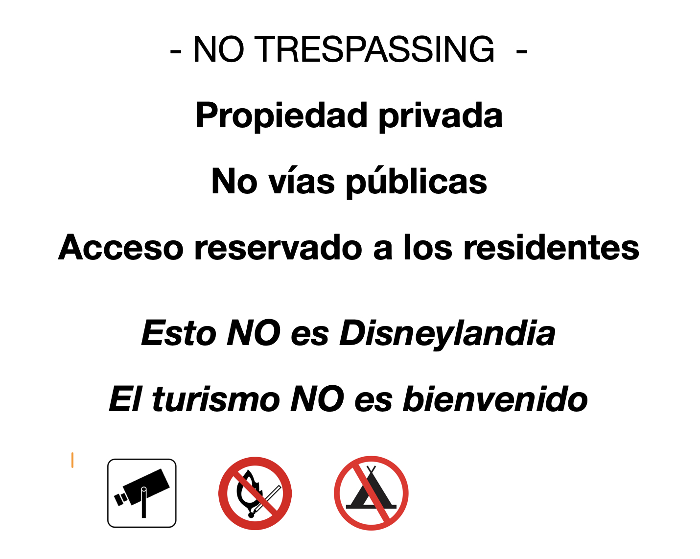
El lago y glaciar Leones se encuentran ubicados dentro del parque nacional Laguna san Rafael, en un sector no abierto a reservas de público ni turismo. Puede evitar multas evitando este sector.
Terraventura Outdoor 31/07/2023
Punto alcanzado: FRENTE AL GLACIAR
Fecha expedición: 09/03/2022
LUGAR ÚNICO, CON TRAVESIA EN BOTE DE VELOCIDAD, JET BOAT, ADRENALINA TOTALMENTE RECOMENDADO
elena sobakina 11/05/2018
Punto alcanzado: Camino de acceso
Fecha expedición: 06/03/2018
La parte "Pichimahuida" del camino cambió de dueños. Ahora es una propiedad privada normal con un camino privado, como todas las demás propiedades en el valle, no un "parque". Los nuevos propietarios pusieron letreros indicadores en el camino de acceso, las reglas de paso son explicadas al inicio de la propiedad.


El camping lo más cercano al lago Leones en el valle se encuentra justo antes del puente sobre el río Meliquina - "Turismo Melikina"
Rafael Carbone 20/05/2017
Punto alcanzado: Nororiente del Lago Leones
Fecha expedición: 09/01/2016
- Trekking muy agradable, de baja dificultad, paisajes espectaculares y lugar muy poco concurrido , no nos encontrámos con nadie haciendo trekking, solo con los australianos dueños del parque.

- Como se describe en "Acceso", no hay ningún letrero indicando el acceso, por lo que es muy fácil pasarse de la entrada desde la carretera.

- Otros comentarios:

   > es necesario un vehículo 4x4, fuimos con un auto sedán y casi nos quedamos en pana.

   > el lugar donde se deja el auto no es amplio, sino a un costado del camino antes de la cadena que corta el camino (foto 1).

   > a considerar para los kms en auto, son los siguientes: desde la carretera hasta puerta pichimahuida: 9 kms. Desde portón del parque hasta estacionamiento: 5 kms
Paulo Cox 11/04/2016
Punto alcanzado: Rocas junto a Ventisquero Leones
Fecha expedición: 20/02/2015
Preciosa excursión al glaciar Leones, por el día. El día mayormente despejado. Hacia el final de la tarde (17hrs aprox.), se encapotó el valle, y cayeron algunos chubascos. Demoramos poco menos de 3 horas hasta Puerto Pascual Díaz desde Pichimahuida; luego otros 40 minutos en bote para cruzar hacia la orilla contraria (luego de contemplar los acantilados primero, y el ventisquero mismo después). Un largo almuerzo gauchesco (hasta poco antes de las 15hrs) en las rocas junto al ventisquero. El tiempo en general estuvo muy bueno durante la semana, permitiéndonos incluso un piquero de cabeza en el lago Leones, a pocos metros del ventisquero, después de un suculento almuerzo. En 20 minutos cruzamos de vuelta el lago. En poco más de 2 horas, luego de desembarcar y guardar el bote, estábamos de regreso en el lugar de partida (alrededor de las 18hrs). Habíamos hace pocos días realizado el sendero de Cerro Castillo, más al Norte.


La compañía, atención, la amabilidad y discreción gauchesca y experiencia, de los anfitriones y nuevos amigos del paseo, Ana María y Pascual (de Kalem Patagonia), son sin dudas unos de los compañeros claves del disfrute y éxito de la excursión al Leones.
Elena Sobakina 25/02/2016
Punto alcanzado: Leones
Estimado Sr Cox,

Se debe mencionar que todo el valle Leones, desde su inicio al fin, es una sucesión de propiedades privadas con un camino vecinal privado que usted utiliso para acceder al glaciar Leones. La caminata pasa por predios privados solo.

La entrada del predio Pichimahuida, que esta una propiedad privada sin ningunas actividades turisticas, esta justo después del río Meliquina, no donde la indico.

¡Consideramos absolutamente inaceptable que puso nuestra propiedad privada en el dominio público turístico mencionado nuestros nombres en un recurso de Internet abierta!

Propietarios de Pichimahuida
Tracks and Waypoints
Glaciar Leones
Glaciar Leones
Colaborador: Paulo Cox
Fecha: 06/11/2015
Sendero tras cruce de El Pedregal
Colaborador: Paulo Cox
Fecha: 07/11/2015
En este pedacito de track, se muestra parte del sendero que es inundado (transformándose en un barreal) por brazos del estero El Pedregal durante el verano. Fue el caso nuestro. En el track completo (de ida) esta parte fue bypasseada usando claros de bosque seco. Aquí dejo la parte oficial del sendero en caso que no haya problemas para utilizarlo.

I did it!