Summary
General Information
Piedra del Águila
Country: Chile
Region: Región de los Lagos
Area: Futaleufú
Nearest city: Futaleufú
Number of journeys: 1
Total distance: 3km (ida y vuelta desde el estacionamiento)
Trail Markings: Frecuente y clara
Trail: Claro y marcado
Route type: Ida y vuelta
Fauna
Flora
Panorámicas / Paisaje
Difficulty:
I did it

Hiking routes
PIEDRA DEL ÁGUILA
Futaleufú
Author: Daniel Perez (CL).
Introduction
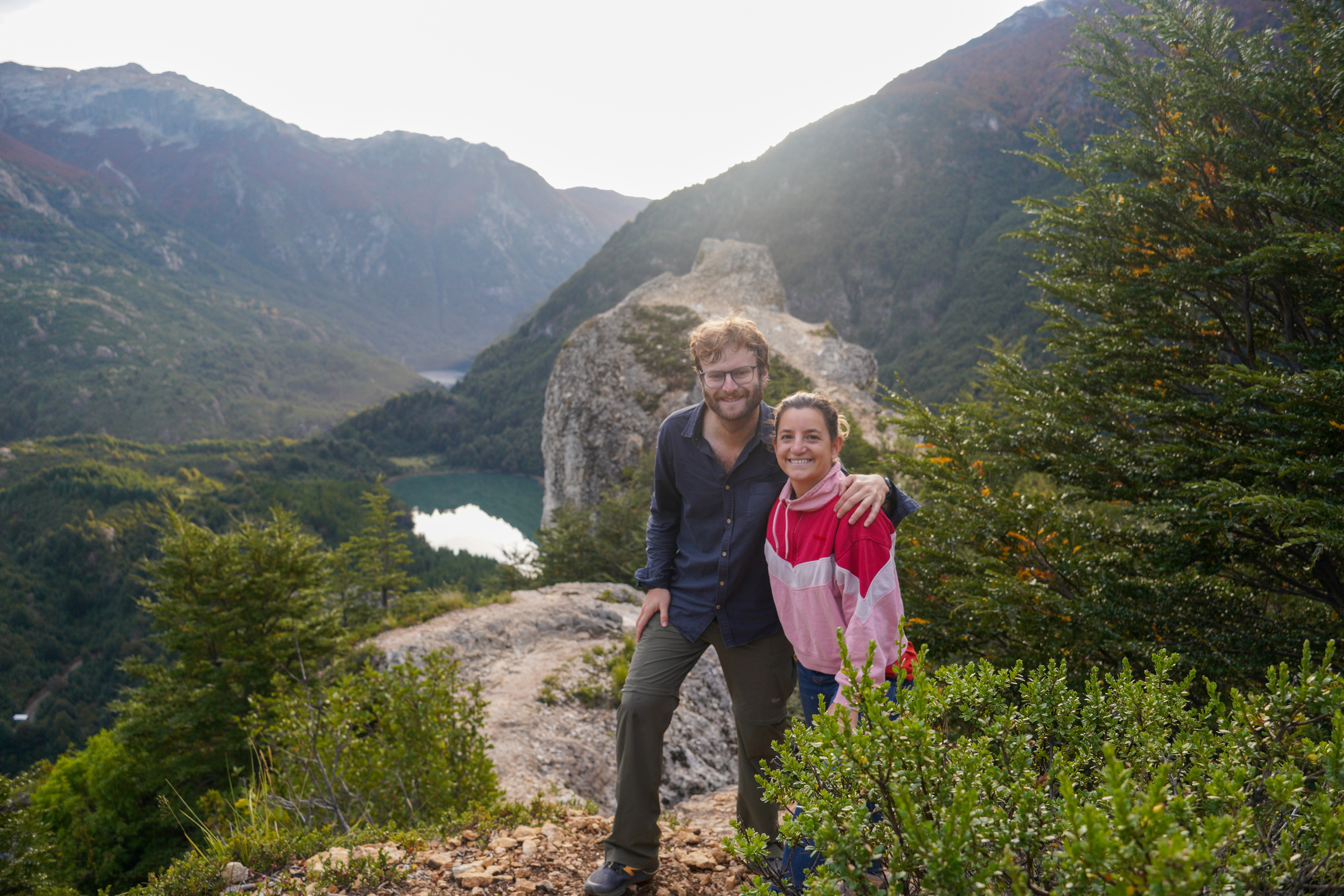
Piedra del Águila – translated as Eagle Rock in English, due to its distinct form – is one of the classic routes around the village of Futaleufú. The route begins some 4.5km from the Plaza de Armas (Main Square) of this town and is an excellent option if you wish to go hiking. Along the way you will have plenty of views of the valley through which flows the River Espolón, as well as of some beautiful lakes like Pinto and Noroeste. You will also be able to see various mountains that spread across the horizon, one of the most incredible sights being that of the mountain Tres Monjas, a well-known symbol of this part of Chilean Patagonia.
Futaleufú is a border town between Chile and Argentina, and is currently on the tourist trail for those visiting the northern part of the Chilean Patagonia. Its history dates back to 1912 when a family from the island of Chiloé, led by Don Celerino Moraga, established themselves in this remote part of Chile. During the twenties more and more families migrated to the area, creating over time the town that you see today.
In the indigenous language the word Futaleufú means Big River or Big Waters, referring to the torrential waters of the nearby River Palena.
Appropriate season
All year round.
Access
Futaleufú – Piedra del Águila
From the main square in Futaleufú, head west along the road Pedro Aguirre Cerda. At the end of this road begins a dirt track that follows the River Espolón along its northern bank. Continue eastwards for a little more than 1.5km until you cross a bridge. Approx. 150m after the bridge there is a turn off heading northwest (right) which marks the way to Piedra del Águila, this turning being well signposted. Take this turning and continue for another approx. 1.2km until reaching a second turn off which leads north (right) and which is also well signposted. Continue along this road for about 150m until crossing over a second bridge which is quite rudimentary. Approx. 150m after the bridge take a third turning to the left (northwest). Continue along the road for 500m until reaching a large plain where you can park. This place marks the beginning of the route.
Permits / Prices
You do not need a permit or to pay an entrance fee to hike this route.
Accommodation / Facilities
None.
Recommendations
- There is nowhere to retrieve water along the route.
- If you don’t have your own car, you can reach the start of the route by walking. This will take an extra 1 to 1½ hour from the main square in Futaleufú (one way).
- The town of Futaleufú offers a range of types of accommodation and touristic services.
Gear
- Trekking boots or high-ankle boots.
- Comfortable clothing, windbreaker and hat, gloves, etc. to keep warm.
- Sun-glasses, sun protection.
- Trekking poles (optional).
-

Daniel Pérez A. - View facing west
-

Daniel Pérez A. - First turning
-

Daniel Pérez A. - Second turning
-

Daniel Pérez A. - Parking area
-

Daniel Pérez A. - Dirt track
-

Daniel Pérez A. - View facing south
-

Daniel Pérez A. - Lakes
-

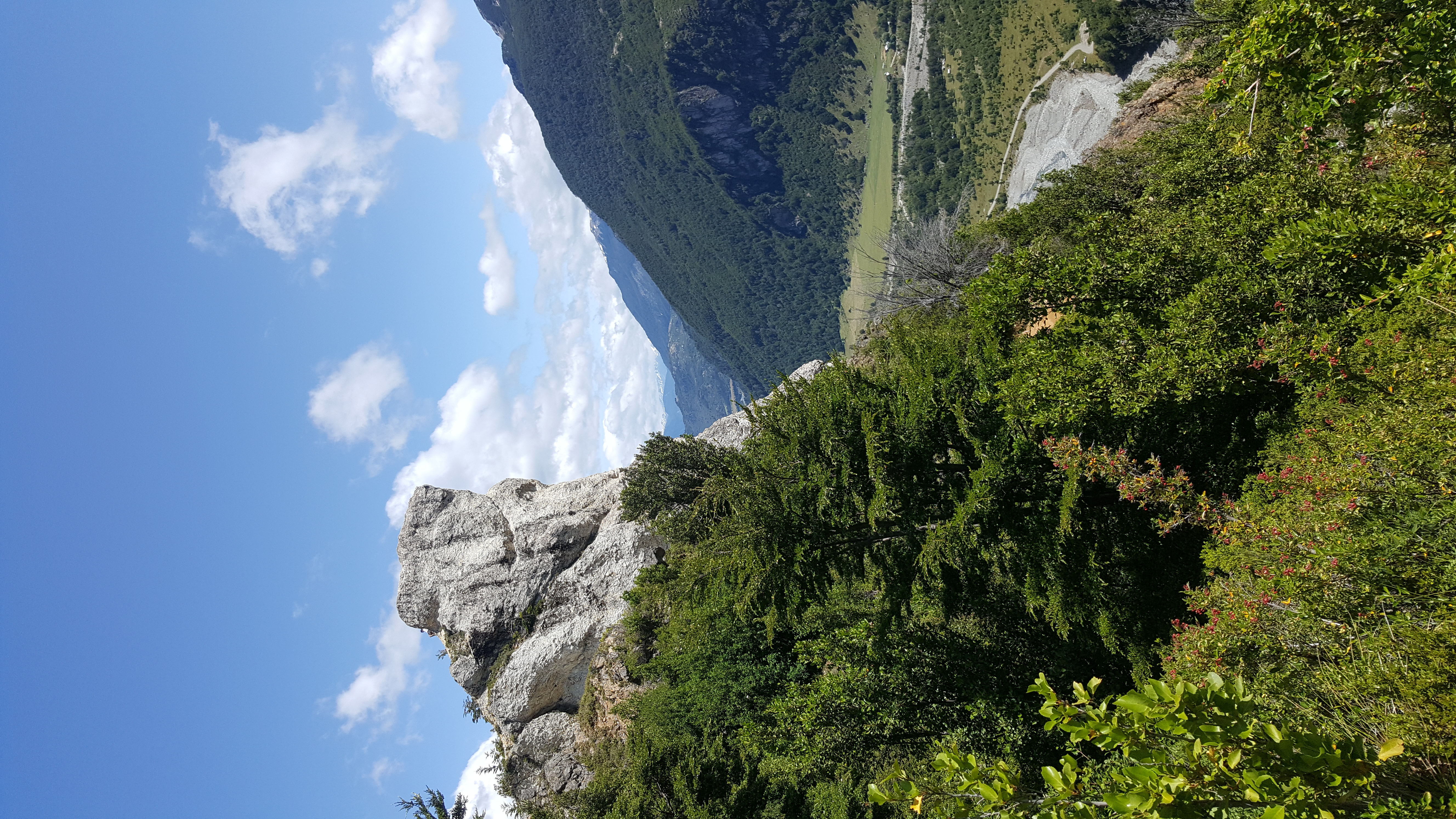
Daniel Pérez A. - Piedra del Águila
-

Daniel Pérez A. - Wooden gate
-

Daniel Pérez A. - Last leg
-

Daniel Pérez A. - Path
-

Daniel Pérez A. - Last metres
-

Daniel Pérez A. - Piedra del Águila
-
Daniel Pérez A. - View facing west
-

Daniel Pérez A. - View facing south
-

Daniel Pérez A. - Descent


Comments
Piedra del Águila
José Mena María Paz Opazo 11/05/2023
Punto alcanzado: Base Piedra del águila
Fecha expedición: 19/04/2023
Muy buen paseo! Nos demoramos 2 horas en subir y volver al auto, considerando unos 45 minutos de subida.
Jorge Ramirez Bolado 09/03/2022
Other excursionists: Paula Durán Alcántara
Fecha expedición: 23/01/2020
Daniel Perez 13/03/2015
Punto alcanzado: Piedra del aguila
Fecha expedición: 25/02/2015
Una buena opción de senderismo si no se tiene transporte propio y no se quiere caminar tanto. La ruta en si no es tan entretenida, ya que gran parte de esta es por camino de auto que hace un poco tedioso el avance. No obstante, la vista a los alrededores es muy linda, por lo que vale la pena la visita. Mucha atención en la parte más alta de la ruta, ya que es un poco expuesta.
Francisco Pérez Arriagada 03/05/2015
Punto alcanzado: Piedra del aguila
Fecha expedición: 25/02/2015
Un sendero muy corto pero que vale la pena visitar. A ratos puede ser un poco aburrido por solo caminar por un camino de autos. Ojo con la caminata en la roca del final de la ruta, es expuesto.

I did it!